Cary, John
A New Map of the Circle of Upper Saxiony with the Duchy of Silesia an Lusatia, divided according to the Congress of...
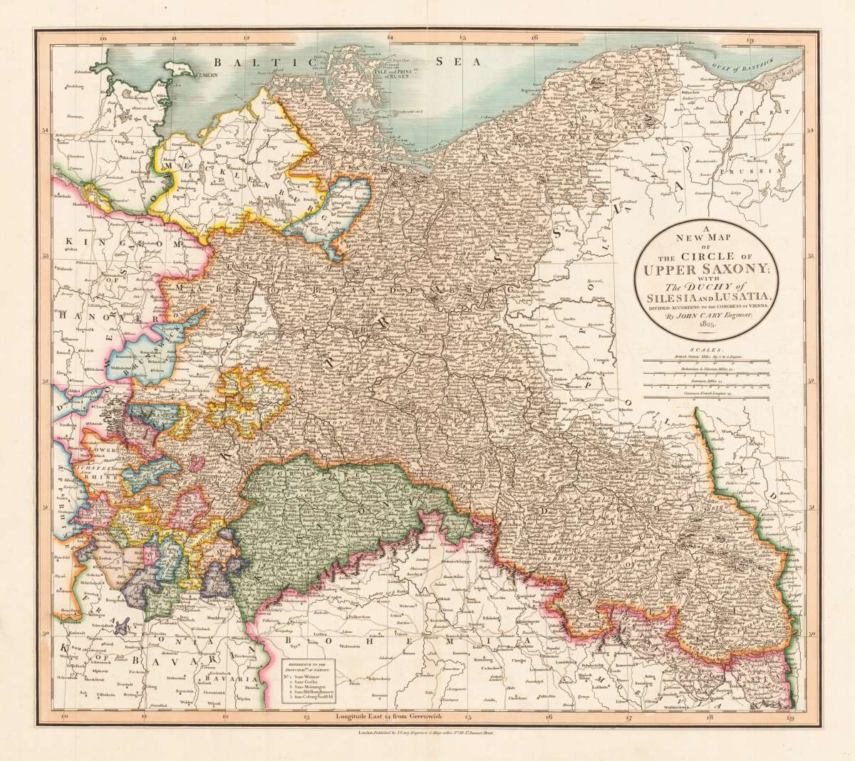
A New Map of the Circle of Upper Saxiony with the Duchy of Silesia an Lusatia, divided according to the Congress of Vienna. By John Cary Engraver. 1825. - Jo...
Eigenschaften
- Published: London
- Published date: 1825
- Type: Antique Map
- Issue date: 1825
- Category: Spain & Portugal
- Technique: Copper engraving / Original color
- Size: 46 x 52 cm (18 x 20,5 inches).
- Stock number: 33418
- Condition: In excellent condition.
Article description
Article description
Hand-Colored Original Copperplate Engraving by John Cary, depicting A New Map of the Circle of Upper Saxiony with the Duchy of Silesia an Lusatia, divided according to the Congress of Vienna. By John Cary Engraver. 1825.. Published London, John Cary, 1825. Sheet: 46 x 52 cm (18 x 20,5 inches).. A fine and original hand-colored example of Cary's celebrated cartographic work, documenting this region of Germany with the precision and decorative artistry characteristic of the 18200s. John Cary was a cartographer active in the 1800s, working in the tradition of European copper-engraved cartography. Their maps are valued by collectors for their historical accuracy and decorative quality. This original copperplate engraving, with original hand coloring depicts the region of A New Map of the Circle of Upper Saxiony with the Duchy of Silesia an Lusatia, divided according to the Congress of Vienna. By John Cary Engraver. 1825., published in London, John Cary, 1825. The map features a decorative Baroque cartouche containing the title inscription. The map records the political and geographic boundaries of the region as understood in 1825, offering a fascinating window into the history of German territorial organization. Sheet measures 46 x 52 cm (18 x 20,5 inches).. In good condition, showing expected signs of age. Ready to frame.A New Map of the Circle of Upper Saxiony with the Duchy of Silesia an Lusatia, divided according to the Congress of Vienna. By John Cary Engraver. 1825. - Jo...
You might also be interested in the following products
 Marchionatus...
 Hand-Colored Original Copperplate Engraving by Matthäus Seutter, depicting Marchionatus Lusatiae Superioris...
€350.00
 Lusatia Superior....
 Hand-Colored Original Copperplate Engraving by Guijelmus Blaeu & Joan., depicting Lusatia Superior. Authore...
€295.00
 Königreich...
 Hand-Colored Original Copperplate Engraving by Tranquillo Mollo, depicting Königreich Sachsen in Wien bey Tranquillo...
€195.00
 Leipzig mit...
 Original Copperplate Engraving by [Anonym], depicting Leipzig mit Delitzsch. Published 1600. Sheet: 15 x 39,2 cm (6 x...
€325.00
Recently viewed products