S. D. U. K.
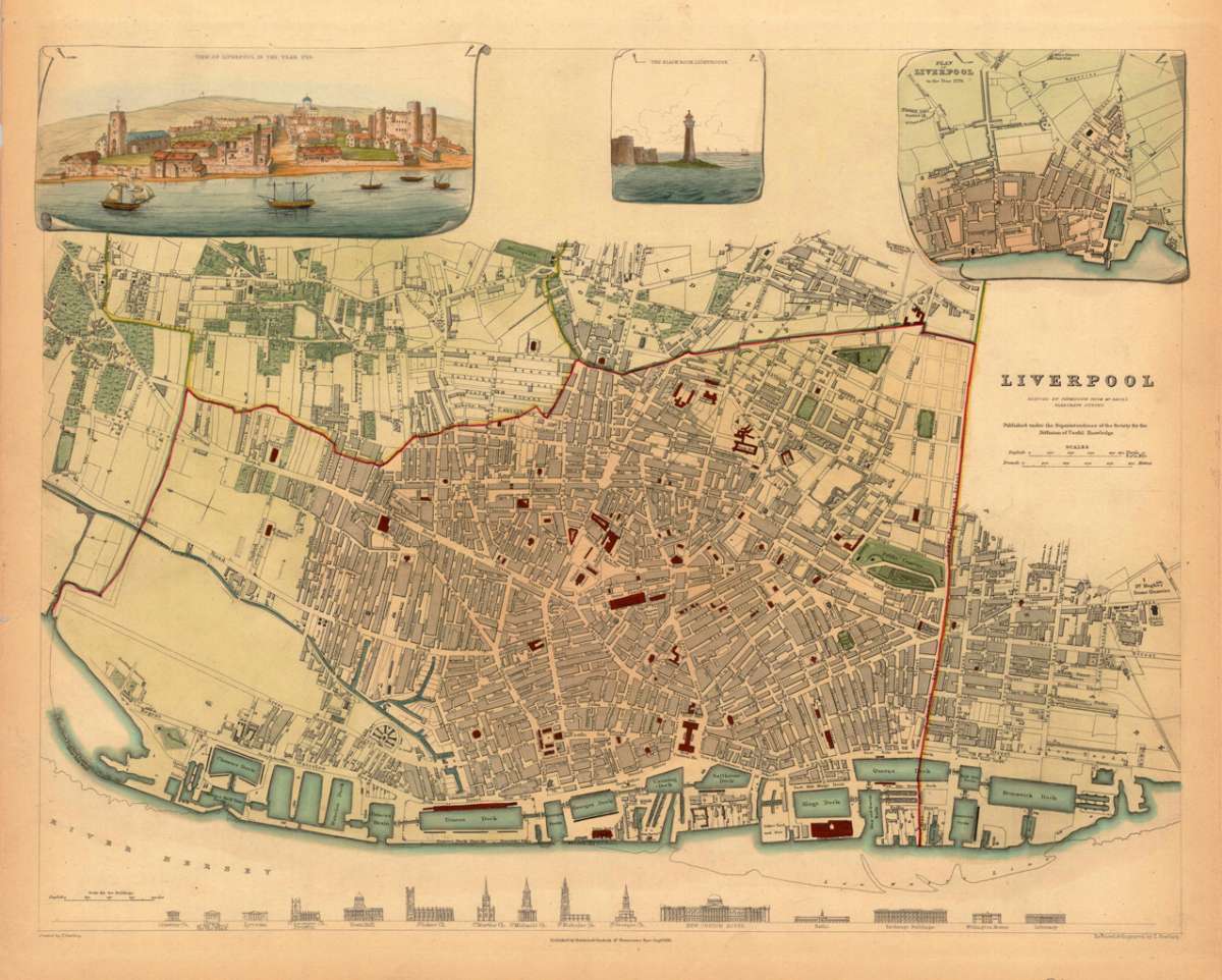
Liverpool Reduced by permision from Gage's elaborate survey. Published under the superintendence of the society...
Eigenschaften
- Published: Baldwin & Cradock , London
- Published date: 1836
- Type: Antique Map, map
- Technique: Steel engraving, hand colored
- Issue date: 1836
- Category: Liverpool
- Size: 300 by 385mm (11¾ by 15¼ inches).
- Stock number: 17470
- Condition: In excellent condition. 300 by 385mm (11¾ by 15¼ inches).
Article description
Article description
Decorative fully hand colored detailled double-page plan of Liverpool, decorative handcolored in wash. This plan of Liverpool is highly accurate and finely hand colored throughout. Ornated in the upper margin with three decorative inset views: Historical view of Liverpool of 1729 - The Black Rock Lighthouse - Plan of Liverpool.You might also be interested in the following products

 De Custen van...
 Fascinating detailed seachart of the south-eastern coast of England showing the coastline from Lizard Point over...
€950.00
 Neueste Karte von...
 Steelengraving, handcolored in outline when published. The detailled map of the British Isles is providing a lot of...
€80.00
 Anglia Cambdeni,...
 Original antique copper engraving, hand colored in outline and wash when published. Decorative detailled map...
€195.00
Recently viewed products