Meyer, Carl
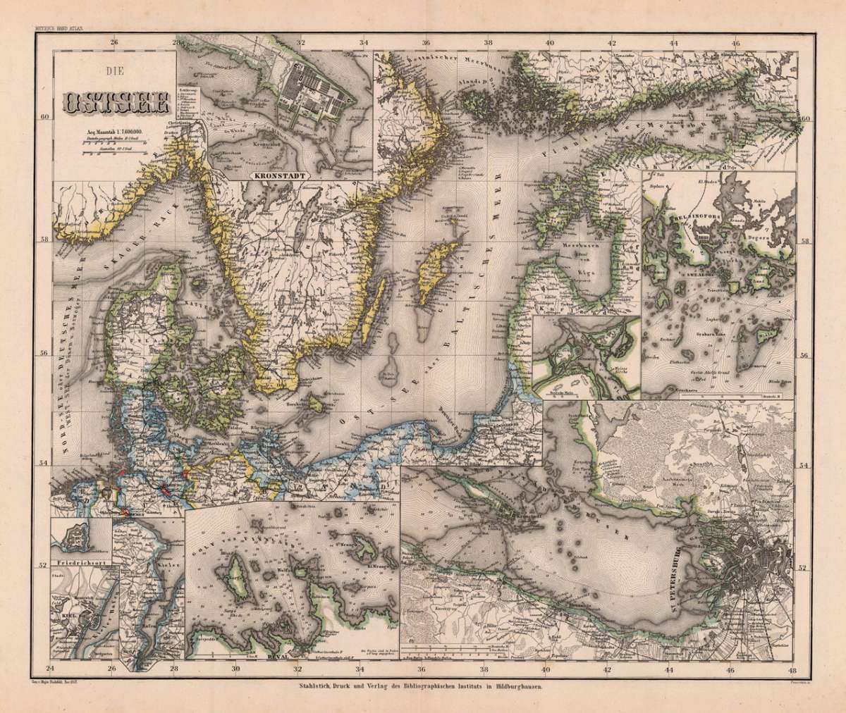
Die Ostsee
Eigenschaften
- Published: Bibliograph. Institut , Hildburghausen
- Published date: 1860
- Type: Antique Map, map
- Technique: Steel engraving, original color
- Issue date: 1860
- Category: Baltic Sea
- Size: 302 by 366mm (12 by 14½ inches).
- Stock number: 19773
- Condition: In excellent condition. 302 by 366mm (12 by 14½ inches).
Article description
Article description
Steel engraving, hand colored in outline when published. This antique map shows us the Baltic Sea. Inside the map are many inset maps, also many small place names, rivers, etc. are engraved. Among the inset maps we find a plan of Kronstadt and a map of the surrounding of St. Petersburg.You might also be interested in the following products
 Prospect Grundris...
 Original antique copper engraving, hand colored in outline and wash when published. Fine detailed map of the...
€845.00
 Pomeraniae Ducatus.
 Original antique copper engraving, uncolored. Published in the first Cloppenburgh edition of Gerhard Mercator's...
€175.00
 The N.E. Part of...
 Copper engraving, uncolored as published. Small and decorative map of the northeastern part of Germany mainly...
€145.00
 Provinz Posen...
 Steel engraving, hand colored in outline when published. Detailed map of Posonia with many place names, rivers,...
€95.00
Recently viewed products