The following products have been found matching your search "1840s": 32
No results were found for the filter!
 Neueste Karte von Maine. Nach den bessten Quellen verbessert.1845.
 Steel engraving, hand colored in outline when published. Detailed and interesting map of the state of Maine. In the...
€145.00
 North America Sheet II the Dominion of Canada Parts of Quebe and New Brunswick and the States of New York, Vermont...
 Steel engraving, hand colored in outline when published. Decorative antique map of Canada, in the centre of the map...
€60.00
 Neueste Karte von Pennsylvania mit seinen Canaelen, Eisenbahnen & c. Nach den besten Quellen bearbeitet. 1845.
 Steel engraving, hand colored in outline and wash when published. Detailed map of the state of Pennsylvania. Inside...
€65.00
 Plate XIII
 Original copper engraving, finely hand colored when published. Fine hand colored copper engraving published in Moses...
€175.00
 Hazelnut tree with butterflies Plate XIV
 Original copper engraving, finely hand colored when published. Fine hand colored copper engraving published in Moses...
€175.00
 Plate XXXI
 Original copper engraving, finely hand colored when published. Fine hand colored copper engraving published in Moses...
€175.00
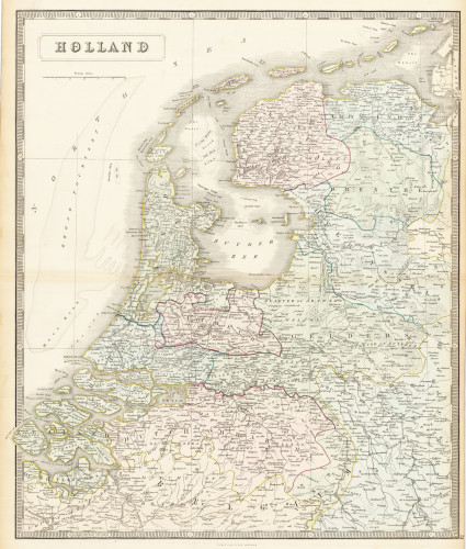
 Holland
 Lithograph, original hand colored in outline. Decorative double page hand colored lithograph antique map, showing...
€95.00
 Teplitz (Böhmen)
 Original Stahlstich, gedruckt und verlegt um 1840-50, verlegt bei Gebr. Franieck in Carlsbad. Dekorative...
€140.00

