Meyer, Joseph
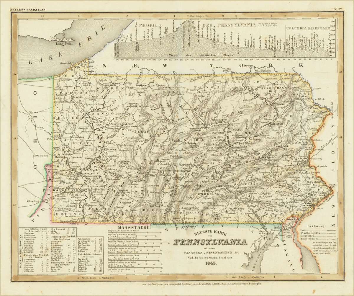
Neueste Karte von Pennsylvania mit seinen Canaelen, Eisenbahnen & c. Nach den besten Quellen bearbeitet. 1845.
Meyer, Joseph – Neueste Karte von Pennsylvania mit seinen Canaelen, Eis... · Antique Map, Steel Engraving · 298 x 369mm · Bibliograph. Institut, Hildburghaus...
Eigenschaften
- Published: Hildburghausen
- Published date: 1845
- Type: Antique Map
- Technique: Steel engraving, original color
- Issue date: 1845
- Size: 298 by 369mm (11 by 14 inches).
- Stock number: 30537
- Condition: In excellent condition.
Article description
Article description
Steel Engraving, hand-colored in outline by Meyer, Joseph, published 1845 by Bibliograph. Institut, Hildburghausen. Image size: 298 by 369mm (11 by 14 inches). From Meyer's acclaimed steel-engraved atlas, one of the finest German cartographic productions of the 19th century. Joseph Meyer (1796–1856) was one of the most prolific and influential German publishers of the 19th century. Born in Gotha, he founded the Bibliographisches Institut, which he moved to Hildburghausen in 1828, and built it into a leading European publishing house. Meyer produced numerous finely engraved atlases, including the celebrated Meyer's Groẞer Hand-Atlas (1843–1860), engraved with exceptional precision on steel plates by his talented team of cartographers including Carl Radefeld. His maps of North American states from the 1840s and 1850s are based on the best available American sources of the period, including Tanner's surveys, and offer a detailed German perspective on the rapidly expanding United States. Meyer's steel engravings, often hand-colored in outline, are treasured by collectors for their technical perfection and historical accuracy. Detailed map of the state of Pennsylvania. Inside the map are many place names, rivers, streets, etc. As well distances are shown on the map. In the lower right corner we find the explanation for this map. The map is also equipped on the top with a profile of the Pennsylvania canal and the Columbia railroad. A table with steam ship routes ( Pittsburg - Louisville, Philadelphia - New York via Trenton, Philadelphia - New York via Bordentown, Philadelphia - Baltimore via New Castle, Philadelphia - Baltimore via Canal) is in the lower left corner of the map. In excellent condition.Meyer, Joseph – Neueste Karte von Pennsylvania mit seinen Canaelen, Eis... · Antique Map, Steel Engraving · 298 x 369mm · Bibliograph. Institut, Hildburghaus...
You might also be interested in the following products
 Pensylvanie....
 Copper Engraving, hand-colored in outline by Buchon, Jean Alexandre, published 1825 by Carez, Paris. Image size: 440...
€110.00
 Delaware and...
 Lithograph, color by Johnson & Ward, published 1862 by Johnson & Ward, New York. Image size: 400 by 320mm (15...
€90.00
 Vereinigte...
 Lithograph, hand-colored in outline by Bromme, Traugott, published 1855 by Hoffm.Verlagsbuchhandlung, Stuttgart....
€80.00
 (Vermont - New...
 Lithograph, hand-colored in outline by Smith, J. Calvin, published 1845 by Th. Fischer, Cassel. Image size: 370 by...
€295.00
Recently viewed products