The following products have been found matching your search "geographi": 60
Or did you mean: geographe | geograph | geography | geographic | geographia | geographie | geographis | geographia sacra
No results were found for the filter!
 Episcopatus Aichstettensis, cum dynastiis et praefecturis suis ac viciniis, hac geographica delineatione accuraté...
 Original antiker Kupferstich in zeitgenössischem Grenzkolorit. Diese dekorative alte Landkarte zeigt das Bistum des...
€295.00
 Der westliche Theil von Mittel-Asien oder Turan mit einem Theil der angaenzenden Laender. Entworfen und gezeichnet...
 Original antique copper engraving, hand colored in outline when published. A detailed and interesting map by the...
€145.00
 Geographia Sacra Ex Conatibus geographicis Abrahami Ortelii.
 Original antique copper engraving, decorative hand colored in outline when published. Published in a Latin text...
€1,150.00
 Accurate Geograph. Deliniation des zu dem Koenigreich Boehmen gehoerigen Egerischen Creisses nebst allen darinnen...
 Beautiful antique copper engraving, decorartive hand colored. This decorative map shows the Egerian Circle; in the...
€480.00
 Charte des Osmanische Reichs in Asien - Nach den neuesten astronomischen Ortsbestimmungen und besten Hülfsmitteln neu...
 Original antique copper engraving, hand colored in outline and wash when published. Antique map of the Ottoman...
€145.00
 Carte d'Allemagne comprenant la Confederation Germanique, l'Empire d'Autriche, le Royaume de Prusse et...
 Original antique copper engraving, hand colored in outline when published. Antique map titled 'Carte de la...
€60.00
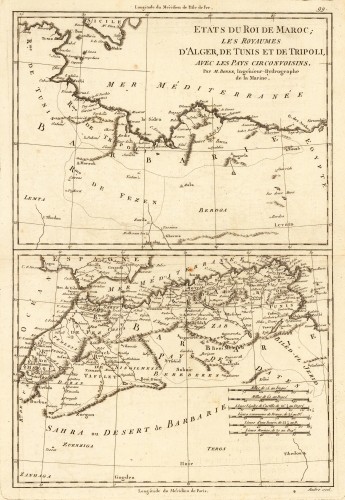
 Etats du Roi de Maroc; les Royaumes D' Alger, De Tunis et de Tripoli, avec les Pays Circonvoisins.
 Original antique copper engraving, uncolored as published. Two interesting maps of North Africa on 1 double page...
€80.00
 Hispaniae Antiquae Tabula. Authore N. Sanson Christianiß. Gall. Regis Geographo A. 1704.
 Copper engraving, hand colored in outline when published. Interesting and detailed map of 'Antique Spain'...
€275.00
 Hispaniae et Portugalliae Regna Per Nicolaum Visscher Cum Privilegio Ordinum Hollandiae et Westfrisie.
 Copper engraving, hand colored in outline and wash when published. A highly decorative map by the famous Dutch...
€594.99
 Terra Sancta, sive Promissionis, olim Palestina recens delineata, et in lucem edita per Nicolaum Visscher Anno 1659....
 Copper engraving, hand colored in outline and wash when published. Old colored decorative antique map of Nicolaus...
€795.00
 Afrique - Mononomatapa - No. 46
 Original lithograph, printed and published ca. 1825 in Vandermaelen's atlas of Africa. This large antique map shows...
€295.00
 Neuseeland mit den neuen Grafschafts-(County)Grenzen.
 Lithograph, handcolored when published. Decorative map which shows New Zealand with its new county borders. The map...
€220.00

