The following products have been found matching your search "hochlandes": 10
Or did you mean: holland | hollandia | new Holland | homeland | commitatus hollandia | hollandois | Heusden Holland | hollandeis
No results were found for the filter!
 Belgium & Holland.
 Engraved map, hand colored in wash and outline, when published. Nice and detailed map of Belgium and Holland, with...
€35.00
 A map of Continent of the East-Indies &c. Explaining what belongs to England, Spain and Holland &c. - By H....
 Copper engraving, decorative handcolored in outline. Small wide and decorative map showing the continent of India...
€375.00
 Neueste Karte von Holland, Belgien und Luxemburg.
 Steel engraving, handcolored in outline, when published. Small and decorative map of the Low Countries, showing many...
€80.00
 Gibraltar erobert vom Prinzen von Hessen Darmstadt durch die ausgesezte Militz von Engel = u. Holland unterm Admiral...
 Copper engraving, uncolored as published. Decorative scenes of the Spanish war of succession 1701-14.
€75.00
 Carte de la Baye D´Hocsieu et des Entrées de la Riviere de Chang Situées. Dans la Province de Fokyen Tirées de...
 Copper engraving, hand colored in outline and wash.
€95.00
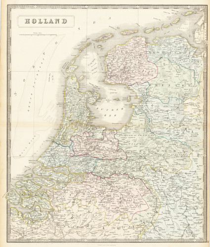
 Holland
 Lithograph, original hand colored in outline. Decorative double page hand colored lithograph antique map, showing...
€95.00
 Das Bolor_Gebirge und die Quellen des Amu_Daria. Original-Zeichnung von Mich de Venukoff K. Russ, Kapitain &...
 Lithograph, original color in outline.
€65.00
 Wie wir einen Eisbären schossen und 100 Pfund Fett von ihm bekamen - was für Massregeln wir ergriffen haben, um nach...
 Lithograph, uncolored.
€35.00
 Fort Hollandois de Palicate Nomme le Fort de Gueldre.
 Copper engraving, hand colored in outline and wash when published.
€65.00
 Carte de l'Ile de Java: partie Occidentale, partie Orientale, Dressée tout nouvellement sur les Mémoirs les plus...
 A beautiful example of Henri Chatelain's important 1720 map of Java. The map was produced for Chatelain's 7...
€850.00

