The following products have been found matching your search "iles": 21
No results were found for the filter!
 Grosbritanien und Irland entworfen von C. F. Weiland. Weimar im Verlage des Geograph. Instituts 1822.
 Copper engraving, hand colored in outline when published. A detailed and interesting map by the German mapmaker Carl...
€295.00
 Germania Antiqua Drawn & Engraved for Dr. Playfairs Atlas
 Original antike Kupferstichkarte in Grenzkolorit. Das Kartenbild reicht von der Nord- und Ostsee bis hin zum...
€70.00
 Insulae de Cabo Verde, Olim Hesperides, Sive Gorgades: Belgice de Zoute Eylanden.
 Original copper engraving, uncolored published. Double page sea chart covering detailed the Cap Verde Islands in the...
€590.00
 Die Stadt Hispahan - Hispahan
 Copper engraving, hand colored in outline and wash. A decorative print depicting Isfahan the capital of Isfahan...
€60.00
 Der westliche Theil von Mittel-Asien oder Turan mit einem Theil der angaenzenden Laender. Entworfen und gezeichnet...
 Original antique copper engraving, hand colored in outline when published. A detailed and interesting map by the...
€145.00
 A New and Accurate Map of the Netherlands from the Sieur Roberts Atlas with Improvements.
 Original antique copper engraving, uncolored. Engraved by J. Gibson Original antique map showing the north-western...
€45.00
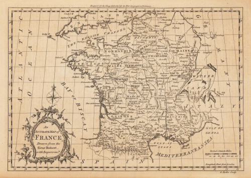
 An Accurate Map of France Drawn from the Sieur Robert, with Improvemts.
 Original antique copper engraving, uncolored. Published in London and engraved for the 'New Geographical...
€80.00
 Nieder- und Ober-Oesterreich oder das Erzherzogthum Oesterreich unter & ob der Enns und das Herzogthum Salzburg
 Original Kupferstich in zeitgenössischem Flächenkolorit. Bearbeitet von C. Gräf. Diese antike Landkarte zeigt das...
€90.00
 Charte des Osmanische Reichs in Asien - Nach den neuesten astronomischen Ortsbestimmungen und besten Hülfsmitteln neu...
 Original antique copper engraving, hand colored in outline and wash when published. Antique map of the Ottoman...
€145.00

