Weiland, Carl Ferdinand
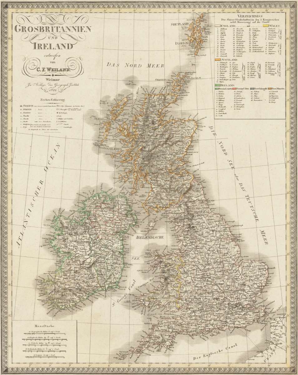
Grosbritanien und Irland entworfen von C. F. Weiland. Weimar im Verlage des Geograph. Instituts 1822.
Eigenschaften
- Published: Weimar
- Published date: 1822
- Category: British Isles
- Technique: Copper engraving / Original color
- Issue date: 1822
- Type: map
- Size: 620 by 495mm (24½ by 19½ inches).
- Stock number: 29372
- Condition: 620 by 495mm (24½ by 19½ inches).
Article description
Article description
Copper engraving, hand colored in outline when published. A detailed and interesting map by the German mapmaker Carl Ferdinand Weiland depicting the British Isles (England, Irland and Scotland), as well the Shetland Islands. Upper left side with the engraved title and explanations for the map on cities, towns, villages, castles, fortresses, lighthouses, streets, channels, etc. In the lower left corner a mileage scale for English, Irish and Scottish miles.You might also be interested in the following products
 Li Regni D'...
 Copper engraving, in contemporary original color in outline. Published in Zatta's "Atlante Novissimo"....
€245.00
 Neueste Karte von...
 Steelengraving, handcolored in outline when published. Detailled map of Great Britain and Ireland with many...
€80.00
 General Carte von...
 Original antique copper engraving, hand colored in outline and wash, when published. Detailled map of the British...
€195.00
 Carte des Grandes...
 Copper-engraving, handcolored in outline, when published. Detailed map by the French cartographer Sr. Robert de...
€350.00
Recently viewed products