The following products have been found matching your search "ing": 152
No results were found for the filter!
 Ting
Ting Original color lithograph. Poster for the Chinese-American painter Walasse Ting's (1929-2010) solo exhibition on...
€175.00
 Karte von den Nord-Westlichen Theilen von America nach Middeltons und Ellis Reisen im J. 1742 und 1746 um einen Weg...
 Original old copper engraving, uncolored as published. This very decorative antique map shows the Hudson Bay Area...
€84.00
 Carte De L' Isle De La Guadeloupe. Pour servir a' l' Historie Générale des Voyages. Par M.B. Ingr. de...
 Copper engraving, hand colored in outline and wash. A detailed map on the island of Guadelupe and Maria Galante....
€86.00
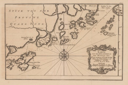
 Karte von den Eylanden in der Mundung des Flusses Canton - Nach den Wahrnehmungen der Schiffahrer entworfen. von N....
 Copper engraving, uncolored as published.
€180.00
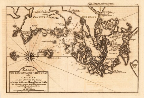
 Karte von dem Eylande Cheu-Chan oder Chusan in der Provinz Che-kiang, nebst den Kusten und benachbarten Inseln. - aus...
 Copper engraving, uncolored as published.
€150.00
 Carte des Isles Amis. Par M. Bonne, Ingr.-Hydrographe. de la Marine. 1760
 Original antique copper engraving, uncolored as published. Thist detailed plan shows du Havre de Tongataboo, Tabouai...
€75.00
 Western Autralia containing the Settlements of Swan-River and King George´s Sound from recent Surveys sent to the...
 Steel engraving, hand colored in outline when published. This map shows West Australia.
€182.00
 Karte von der Einfahrt des Flusses Canton nach den neuesten Wahrnehmungen entworfen von N. Bellin Ing. de la Marine.
 Copper engraving, uncolored as published. This detailed antique map shows the entrance of the river Canton with its...
€95.00
 Les Royaumes d'Espagne et de Portugal: Par M. Bonne, Ingr.-Hydrographe de la Marine.
 Copper engraving, hand colored in outline and wash. Rigobert Bonne (1727-1794) was a French cartographer of the...
€75.00
 Carte de L'Isle de Caienne et de ses Environs. Pour servir a l`Histoire generale des Voyages. Par le Sr. Bellin...
 Copper engraving, hand colored in outline and wash.
€82.00
 Die Kolonien im Munizip Santa Cruz (Rio Grande do Sul.) Nach den Aufnahmen v. Ingr. C. Trein u. Anderen entw. u....
 Lithograph, original hand color in outline.
€95.00
 Carte du Chili depuis le Sud du Perou Ju Squ'au Cap horn avec partie des Regions qui en sont a L'Est. Par...
 Orinigal antique copper engraving, uncolored. The decorative map is showing Chili, Patagonia, the Magellan Street...
€80.00

