The following products have been found matching your search "language": 87
No results were found for the filter!
 Neueste Karte von England nach den bessten Quellen entworfen u. gezeichnet vom Hauptm. Radefeld. 1844.
 Steelengraving, handcolored in outline when published. The detailled map of England is providing a lot of...
€80.00
 Nieuwe Zeekaart Van t' Eerste Gedeelt Van t' Canaal Tufschen Engeland en Vrankryk ... The New Sea map of...
 Original antique copper engraving, uncolored as published. Decorative hand colored seachart showing the English...
€495.00
 Neueste Karte von Grossbritannien und Ireland. Nach den besten Quellen entworf. u. gezeichn. von Hauptm. Radefeld....
 Steelengraving, handcolored in outline when published. Detailled map of Great Britain and Ireland with many...
€80.00
 Neueste Karte von Grossbritannien und Ireland. Nach den bessten Quellen entworf. u. gezeichn. von Hauptm. Radefeld....
 Steelengraving, handcolored in outline when published. Detailled map of Great Britain and Ireland with many...
€80.00
 Neueste Karte von Schotland Nach den bessten Quellen entworfen u. gezeichnet vom Hauptm. Radefeld. 1844.
 Steelengraving, handcolored in outline when published. The detailled map of Scotland is providing a lot of...
€95.00
 Pomeraniae Ducatus.
 Original antique copper engraving, uncolored. Published in the first Cloppenburgh edition of Gerhard Mercator's...
€175.00
 Argow
Argow Original antique copper engraving, uncolored. Published in the first Cloppenburgh edition of Gerhard Mercator's...
€120.00
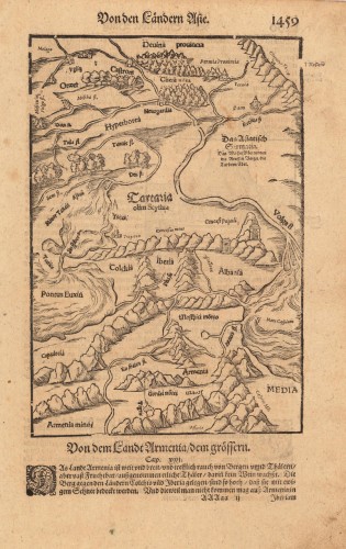
 Von den Ländern Asie. - Von dem Landt Armenia / dem grössern.
 Woodcut published 1628 in the Cosmographia by Sebastian Münster. Early woodcut map published in the 1628 edition...
€95.00
 Die Englischen Colonie-Laender Auf den Inseln von America und zwar die Insuln S. Christophori Antegoa Iamaica...
 Original antique copper engraving in full contemporary handcolor in wash and outline when published. Large detailed...
€1,100.00
 Pas-kaart van de Grand Banqu by Terra Neuff ...
 Original antique copper engraving, uncolored as published. Decorative sea chart showing Terra Nova in North East...
€645.00
 Angliae II Tabula - Angleterre. Northumbria, Cumberlandia et Dunelmensis Episcopatus. .
 Original antique copper engraving, uncolored as published. Detailed map of Cumberland and North Umbria at the...
€175.00
 Cornubia Devonia, Somersetus, Dorchestia, Wiltonia, Glocestra, Monumetha, Glamorgan, Caermarden, Penbrok, Cardigan,...
 Original antique copper engraving, uncolored as published. A fine copy in a dark impression, full margins as...
€195.00

