The following products have been found matching your search "languages": 83
No results were found for the filter!
 Warwicum Northhamtonia Huntingdonia Cantabrigia, Suffolcia, Oxonium ... Cantium Southsexia.
 Original antique copper engraving, uncolored when published. Uncoloured copper engraved map of the South East of...
€195.00
 Fionia
 Original antique copper engraving, uncolored. Published in the first Cloppenburgh edition of Gerhard Mercator's...
€150.00
 Thüringen
 Original antique copper engraving, hand colored when published. The colored title cartouche is in the lower right...
€350.00
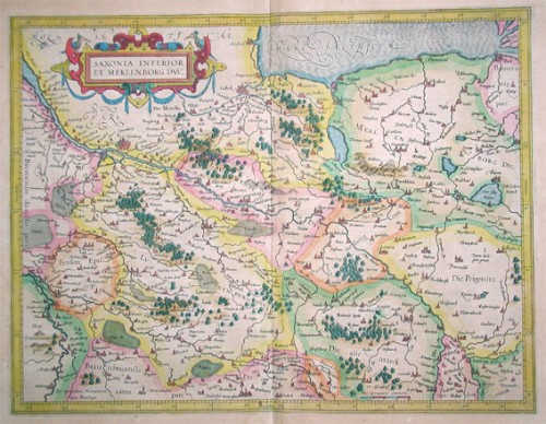
 Niedersachsen
 Kupferstichkarte in zeitgenössischem Grenzkolorit, verlegt von Jodocus Hondius. Copper engraving published by...
€300.00
 Elsass
 Original antique copper engraving, hand colored in outline and wash when published. Copper engraving published by...
€240.00
 Karte von den Nord-Westlichen Theilen von America nach Middeltons und Ellis Reisen im J. 1742 und 1746 um einen Weg...
 Original old copper engraving, uncolored as published. This very decorative antique map shows the Hudson Bay Area...
€84.00
 Hassia Landgraviatus
 Original antique copper engraving, uncolored. A fine copy in a dark impression, full margins as published. Engraved...
€145.00
 Nassovia Comitatus.
 Original antique copper engraving, uncolored. A fine copy in a dark impression, full margins as published. A fine...
€145.00
 Waldeck Comitatus.
 Original antique copper engraving, uncolored. A fine copy in a dark impression, full margins as published. Nice...
€145.00
 Die Englischen Colonie-Laender Auf den Inseln von America und zwar die Insuln S. Christophori Antegoa Iamaica...
 Original antique copper engraving in full contemporary hand color in wash and outline when published. Large detailed...
€545.00
 Neueste Karte von England nach den besten Quellen entworfen u. gezeichnet vom Hauptm. Radefeld. 1844
 Steelengraving, handcolored in outline when published. The detailled map of the British Isles is providing a lot of...
€80.00
 Neueste Karte von Grossbritannien und Ireland Nach den besten Quellen entworf. u. gezeichn. von Major Radefeld. 1850.
 Steelengraving, handcolored in outline when published. Detailled map of Great Britain and Ireland with many...
€80.00

