The following products have been found matching your search "mac": 30
No results were found for the filter!
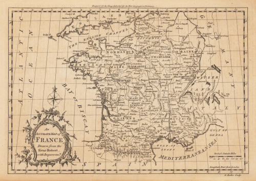
 An Accurate Map of France Drawn from the Sieur Robert, with Improvemts.
 Original antique copper engraving, uncolored. Published in London and engraved for the 'New Geographical...
€80.00
 Gray's New Map of Indiana
 Lithograph, original hand colored in outline and wash. Detailed map, colored by counties and showing townships,...
€80.00
 Gray's New Map of Georgia by Fank A. Gray
 Lithograph, original color in outline and wash. Detailed map, colored by counties and showing townships, towns,...
€70.00
 Gray's New Map of New England
 Lithograph, original color in outline and wash. Detailed map, colored by counties and showing townships, towns,...
€95.00
 Gray's New Map of Massachusetts, Rhode Island and Conneticut
 Lithograph, original color in outline and wash. Detailed map, colored by counties and showing townships, towns,...
€95.00
 A map of the West Indies and Middle Continent of America from the latest Observations by John Blair L.L.D. &...
 Copper engraving, uncolored, engraved by Thomas Kitchin. The map shows the West Indies, Florida, the Southern United...
€375.00
 A New Map of Scotland, from the latest Authorities.
 Copper engraving, handcolored in outline and wash when published. Large and very detailed map of Scotland divided up...
€295.00
 Macfarlane´s Erforschung des Flusses Mai-Kassa (Baxter) im südl. Neu-Guinea. - Von A. Petermann
 Original lithograph in colors, when published. Detailled map showing the expedition of MacFarlane in southern New...
€50.00
 Western Autralia containing the Settlements of Swan-River and King George´s Sound from recent Surveys sent to the...
 Steel engraving, hand colored in outline when published. This map shows West Australia.
€182.00
 New South Wales - compiled under the Superintendence of the Society for the diffusion of Useful Knowledge. From the...
 Steel engraving, hand colored in outline and wash. This map shows New South Wales. Inside the map are many place...
€175.00
 Philadelphia - Outline map of the county and city of Philadelphia and Vicinity
 Lithograph, original hand colored in outline and wash. This antique map shows a plan of Philadelphia in Pennsylvania...
€125.00
![General Karte von einem Antique General Karte von einem Theil des Russischen Reichs in Gouvernement s und Kreise eingetheilet, worauf die Post- und andere Hauptstrassen angezeigt sind bey Sr. Russisch Kayserlichen Majestaet Karten Depot im Jahre 1799 entworffen und gestochen. [folded map on linen] Aus dem russischen übersetzt, die Gouvernements Grentzen nach den Kayserlichen Ukasen vom October 1801 u: Mertz 1802 u: abgeändert, die Schiffbarkeit der Flüsse und ihre Vereinigungs Canäle zwischen den Weissen, Baltischen, Schwartze](https://bergbook.com/media/image/8a/ec/db/23098_500x500.jpg) General Karte von einem Theil des Russischen Reichs in Gouvernement s und Kreise eingetheilet, worauf die Post- und...
General Karte von einem Theil des Russischen Reichs in Gouvernement s und Kreise eingetheilet, worauf die Post- und... Copper engraving, hand colored in outline when published. Large folding map dissected on linen in four sheets, to...
€550.00

