Gray & Son
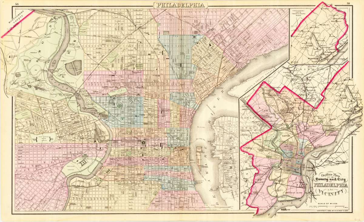
Philadelphia - Outline map of the county and city of Philadelphia and Vicinity
Gray & Son – Philadelphia - Outline map of the county and city of Ph... · Antique Map, Lithograph · 413 x 720mm · O.W. Gray & Son, Philadelphia 1883
Eigenschaften
- Published: O.W. Gray & Son , Philadelphia
- Published date: 1883
- Type: Antique Map, map
- Technique: Lithograph / Original color.
- Category: Philadelphia
- Issue date: 1883
- Size: 413 by 720mm (16 by 28 inches).
- Stock number: 19671
- Condition: In excellent condition. One tiny marginal tear at the lower blank margin, outside the image of the map. 413 by 720mm (16 by 28 inches).
Article description
Article description
Lithograph, hand-colored in outline by Gray & Son, published 1883 by O.W. Gray & Son, Philadelphia. Image size: 413 by 720mm (16 by 28 inches). From Gray's Atlas — one of the most important American commercial atlases of the post-Civil War era. O.W. Gray & Son was a leading Philadelphia-based cartographic publishing firm of the post-Civil War era, founded by Ormando Willis Gray, a civil and topographical engineer. Their Gray's Atlas of the United States (1873) and its successors remained among the most commercially successful American atlases of the 1870s and 1880s. The firm's maps are celebrated for their clear depiction of county boundaries, railroad networks, and topographical features. Philadelphia in 1883 — the subject of this atlas sheet — was America's third-largest city, and the Gray firm's meticulous survey of its counties and neighborhoods constitutes an essential primary document of the city's urban geography in the Gilded Age. This antique map shows a plan of Philadelphia in Pennsylvania around 1883. This decorative ground plan in a bird´s eye view is very detailed engraved, it shows street names, important buildings, parks, railroads, etc. At the right side we find an inset map showing the county and city of Philadelphia and its vicinity. In excellent condition. One tiny marginal tear at the lower blank margin, outside the image of the map.Gray & Son – Philadelphia - Outline map of the county and city of Ph... · Antique Map, Lithograph · 413 x 720mm · O.W. Gray & Son, Philadelphia 1883
You might also be interested in the following products
 Delaware and...
 Lithograph, color by Johnson & Ward, published 1862 by Johnson & Ward, New York. Image size: 400 by 320mm (15...
€90.00
 Vereinigte...
 Lithograph, hand-colored in outline by Bromme, Traugott, published 1855 by Hoffm.Verlagsbuchhandlung, Stuttgart....
€80.00
 (Vermont - New...
 Lithograph, hand-colored in outline by Smith, J. Calvin, published 1845 by Th. Fischer, Cassel. Image size: 370 by...
€295.00
 Gray's New...
 Lithograph, original color in outline by Gray, Frank, published 1884 by O.W. Gray & Son, Philadelphia. Image...
€95.00
Recently viewed products