The following products have been found matching your search "much": 45
Or did you mean: mach | Europens Pracht und Macht | macht | Europeans Macht und Pracht | munich | muehl | munch | muench
No results were found for the filter!
![General Karte von einem Antique General Karte von einem Theil des Russischen Reichs in Gouvernement s und Kreise eingetheilet, worauf die Post- und andere Hauptstrassen angezeigt sind bey Sr. Russisch Kayserlichen Majestaet Karten Depot im Jahre 1799 entworffen und gestochen. [folded map on linen] Aus dem russischen übersetzt, die Gouvernements Grentzen nach den Kayserlichen Ukasen vom October 1801 u: Mertz 1802 u: abgeändert, die Schiffbarkeit der Flüsse und ihre Vereinigungs Canäle zwischen den Weissen, Baltischen, Schwartze](https://bergbook.com/media/image/8a/ec/db/23098_500x500.jpg) General Karte von einem Theil des Russischen Reichs in Gouvernement s und Kreise eingetheilet, worauf die Post- und...
General Karte von einem Theil des Russischen Reichs in Gouvernement s und Kreise eingetheilet, worauf die Post- und... Copper engraving, hand colored in outline when published. Large folding map dissected on linen in four sheets, to...
€550.00
 Die Zee Custen van Ruslant, Laplant, Finmarcken, Spitsbergen en Nova Zemla. t'Amsterdam, By Pieter Goos...
 Copper engraving, finely hand colored in outline, when published. Partially heightened in gold. A highly decorative...
€1,650.00
 Pascaerte Van't Westelycke Deel van Oost Indien, Van Cabo de Bona Esperanca, tot C. Comorin. Tot Amsterdam,...
 Copper engraving, finely hand colored in outline, when published. Partially heightened in gold. The map of the...
€3,500.00
 Protoparchiae Mindelhemensis Nova Tabula Geographica.
 Original antique copper engraving, hand colored in outline and wash when published. Diese historische Karte zeigt...
€325.00
 Tartariae Sive Magni Chami Regni Tipus. - Tartaria
 Copper engraving, uncolored as published on the full text sheet. Fine engraved rare map of Tartary and the Northwest...
€145.00
 Carte De L' Asie dressée sur les Relations les plus nouvelles, principalement sur les Cartes de Russie, de la...
 Copper-engraving, handcolored in outline, when published. Detailled map by the French cartographer Sr. Robert de...
€425.00
 Holmia. Stockholm
 Original copper engraving. Engraved by I. G. Ringle (1691 - 1761). Martin Engelbrecht (Augsburg 1684- 1756...
€395.00
 North America Index Map to Canada and the United States
 Original antique steel engraving, hand colored in outline when published. This North America map shows the East...
€65.00
 North America Sheet I Nova-Scotia with Part of New Brunswick and Lower Canada.
 Original antique steel engraving, hand colored in outline when published. This North America map shows the east...
€70.00
 North America Sheet VI New York, Vermont, Maine, New Hampshire, Massachusetts, Connecticut, Rhode Island, and New...
 Original antique steel engraving, hand colored in outline when published. This North America map shows the east...
€95.00
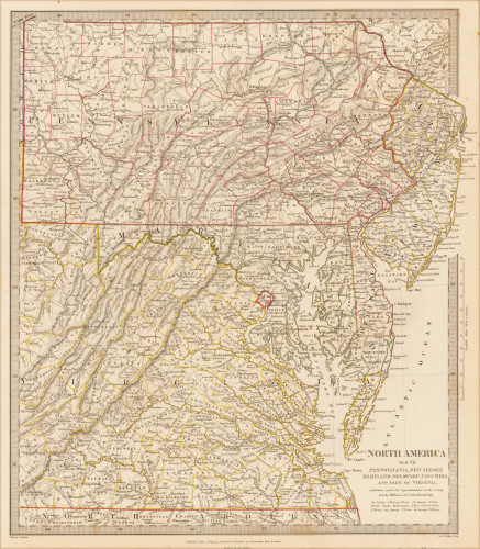
 North America Sheet VII Pennsylvania, New Jersey, Maryland, Delaware, Columbia and Part of Virginia.
 Original antique steel engraving, hand colored in outline when published. This North America map shows Pennsylvania,...
€60.00
 North America Sheet XIII Parts of Louisiana, Arkansas, Mississippi, Alabama & Florida.
 Original antique steel engraving, hand colored in outline when published. This North America map shows Parts of...
€110.00

