The following products have been found matching your search "north africa": 78
Or did you mean: Africa | north | african | norah | AFRICA MAPS | africae | North Sea | north america
No results were found for the filter!
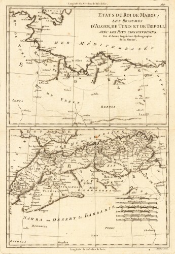
 Etats du Roi de Maroc; les Royaumes D' Alger, De Tunis et de Tripoli, avec les Pays Circonvoisins.
 Original antique copper engraving, uncolored as published. Two interesting maps of North Africa on 1 double page...
€80.00
 In Notiam Ecclesiasticam Africae Tabula Geographica Auctore G. De L' Isle Christianissimi Francorum Regis...
 Copper engraving, handcolored in outline, when published. Drawn and engraved by j.B. Liebaux after cartographic...
€220.00
 Tabula Africae II (Algeria and Tunesia)
 Fine copper-engraved map, printed into the full text page, published in 'Geografia ... Universale de la...
€155.00
 Tabula Africae III (Egypt)
 Fine copper-engraved map, printed into the full text page, published in 'Geografia ... Universale de la...
€155.00
 Tabula Africae I (Mauretania)
 Fine copper-engraved map, printed into the full text page, published in 'Geografia ... Universale de la...
€145.00
 Topographica Repraesentatio Barbarici Portus et Urbis Munitae Oran una cum adjacente ora maritima, quae sita est in...
 Original antique copper engraving in contemporary hand color in wash and outline when published. This decorative...
€375.00
 Mavretania et Numidia. - Per Ch: Weigelium Norimb: cum Privilegio S. Caes: Majestatis.
 Original antique copper engraving, hand colored in outline and wash when published. Decorative map of Mauritania and...
€145.00
 The west Part of Barbary containing Fez. Marocco Algiers and Tunis. - The east Part of Barbary containing Tripoli...
 Copper engraving, uncolored as published. Published in Hermann Moll's 'Atlas Minor' 1736 in...
€120.00
 Barbariae et Biledulgerid, Nova Descriptio.
 Original copper engraving, published 1608 in an Italian text edition of the 'Theatrum Orbis Terrarum'. A good and...
€350.00
 Ein Mitternächtischer Theil des Alten Africae - Partie Septentrionale de L'Ancienne Afrique - Mauritanie -...
 Copper engraving, hand colored in outline and wash.
€35.00
 Karte von der ostlichen Küste von Africa, von dem XIII Grade Süderbreite bis zu dem XVI Grade Norderbreite, Aus der...
 Copper engraving, hand colored in outline and wash. A fine detailed and interesting map engraved by Bellin after...
€155.00
 Paskaart Van de Kust van Maroca Beginnende Van Larache. tot aan C. Cantin. Met syn Diepte en Droogte dus-ver...
 Original antique copper engraving, uncolored as published. Decorative early sea chart, orientated with the North to...
€395.00

