The following products have been found matching your search "zentralafrika": 116
Or did you mean: central italy | central | Central Asia | zentralasien | central america | central asia | 1852 Central America map | zentralamerika
No results were found for the filter!
 Der königlichen Republik Polen Woiwodschaft Podlachien mit dem obern Theileder Woiwodschaft Lublin, oder Klein Polens...
 Original copper engraving, hand colored in wash and outline, when published. The Austrian cartographer Franz...
€145.00
 Des Königreichs Schweden mittlerer Provinzen. Nro. 69.
 Original copper engraving, hand colored in wash and outline, when published. The Austrian cartographer Franz...
€225.00
 Neueste Karte von Centralamerica und West Indien. Entworf. u. gezeichn. v. Hauptm. Radefeld. 1843.
 Steel engraving, hand colored in outline when published. A detailed map of the West Indies, Panama and Central...
€132.00
 Macedonia Epirus et Achaia. Per Gerardum Mercatorem Cum Privilegio.
 Original antique copper engraving, uncolored as published. This map shows present day Thrace, Macedonia, Epirus,...
€295.00
 General Karte von dem Königreichen Schweden Daenemark u. Norwegen mit Grönland und den Inseln Istland und Foeröer....
 Original copper engraving, hand colored in wash and outline, when published. The Austrian cartographer Franz...
€225.00
 Karte von dem Koenigreiche Preussen nach Suchodolez und Endersch neu verzeichnet herausgegeben von Franz Joh. Jos....
 Original copper engraving, hand colored in wash and outline, when published. This large antique map by Franz Johann...
€245.00
 Das fünffte Buch Sarmartia Asie.
 Woodcut map, finely hand colored in wash by a later hand. Published in the ,Cosmographia' by Sebastian Münster...
€90.00
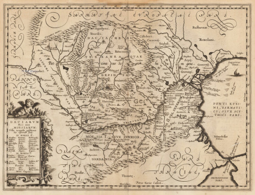
 Vetus Descriptio Daciarum Nec non Moesiarum Petrus Kaerius Caelavit.
 Original antique copper engraving. This interesting map shows Romania. Romania is a country at the crossroads of...
€395.00
 (Coast of West Africa)
 Copper engraving, hand colored in outline when published. This decorative map shows the central Westcoast of Africa...
€75.00
 Bergsystem von Nord-America 1850. Nach den neuesten Forschungen entw. u. gez. v. Hauptm. C. Radefeld.
 Original steel-engraving, hand colored in outline, when published. Detailed fine map of North-America s mountain...
€140.00
 Bergsystem von Nord-America 1848. Nach den neuesten Forschungen entw. u. gez. v. Hauptm. C. Radefeld.
 Original steel-engraving, hand colored in outline, when published. Detailed fine map of North-America s mountain...
€145.00
 North America
 Original lithograph, hand colored in outline, when published. Detailed fine map of North-America hand colored in...
€95.00

