Moll, Herman
A Map of y Island of Bermudos. Divided into its Tribes, wth the Castles, Forts, &c. By H.M.
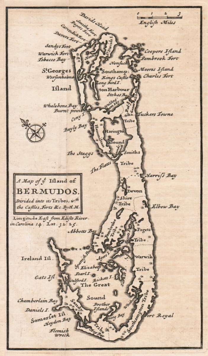
Eigenschaften
- Published: London
- Published date: 1736
- Technique: Copper engraving / Uncolored
- Issue date: 1736
- Type: map
- Category: Bermudas
- Size: 176 by 102mm (7 by 4 inches).
- Stock number: 30064
- Condition: In very good condition. A strong impresion.
Article description
Article description
Copper engraving, uncolored as published. The Geographer Hermann Moll worked came originally from the Netherlands and worked in London in the beginning for Moses Pitt. Later he became one of the important map publishers in England. The atlases, which he published were widely well known. He engraved as well maps for other English publishers (John Seller, etc.) .You might also be interested in the following products
 Nieuwe Paskaert...
 Original antique copper engraving, uncolored as published. This sea chart shows Gualate. In the upper right corner...
€545.00
 Nieuwe Paskaert...
 Original antique copper engraving, uncolored as published. The Dutch firm and printing house van Keulen was one of...
€495.00
 Eyland Mayo -...
 Copper engraving, uncolored as published. Along the coastlines engraved anchor places, as well names of the bays,...
€45.00
 Isles du...
 Original antique copper engraving, uncolored as published. This map shows the Isles of Cap Verde which are St....
€75.00
Recently viewed products