Wharton, W.J.L.
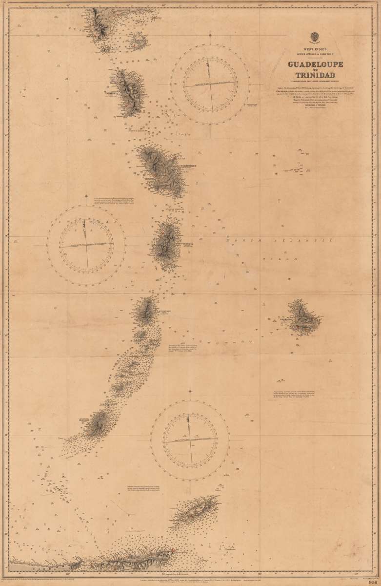
West Indies Lesser Antilles or Caribbee 1st Guadeloupe to Trinidad compiled from the last Government surveys
Eigenschaften
- Published: London
- Published date: 1886
- Technique: Steel engraving
- Issue date: 1886
- Type: map
- Category: Atlantic Islands
- Size: 101.3 x 64,5 cm (40 x 25,5 inches).
- Stock number: 34644
- Condition: In excellent condition.
Article description
Article description
Original antique steel engraving. Admiralty chart, designed as an aid to navigation at sea. Chart Number 956, published at the Admiralty 1886, large corrections to 1889. Shipnavigation chart for sailing tetween Guadeloupe and Trinidad with the Islands Dominica, Marie Galante, Martinique, St. Lucia, St. Vincent, Barados, Grenada and Torago between.You might also be interested in the following products
 Moluccae Insulae...
 Original antique copper engraving, hand colored in outline and wash when published. A highly decorative map of the...
€550.00
 Pascaert van...
 Original antique copper engraving, uncolored as published. Detailed chart of the Northeastern part of Canada,...
€1,750.00
 Pascaarte vande...
 Copper Engraving, uncolored by van Keulen, Joan, published 1684-1704 by Johannes van Keulen, Amsterdam. Image size:...
€1,100.00
 Guiana sive...
 Copper engraving, hand colored in outline and wash when published. French text edition. Decorative map extending...
€325.00
Recently viewed products