Imray, James
Guadeloupe
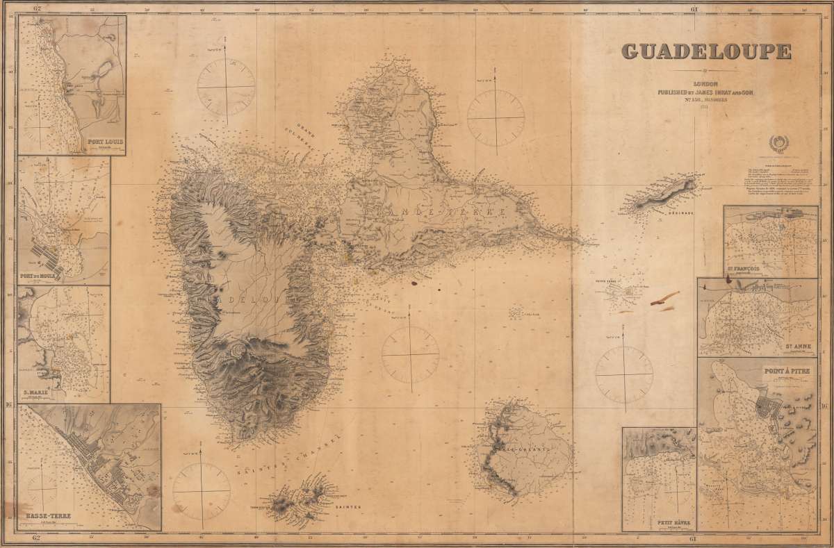
Eigenschaften
- Published: London
- Published date: 1914
- Technique: Steel engraving
- Issue date: 1914
- Type: map
- Category: Atlantic Islands
- Size: 96,8 x 68.2 cm (38 x 26.75 inches).
- Stock number: 34662
- Condition: In good condition, partly restored on the backside.
Article description
Article description
Original antique steel engraving. Large sea chart of Guadeloupe and its surroundings with 8 inset maps of the harbours. Designed very detailed as an aid for navigation at sea, using the Mercator projection, so the position can be taken directly from the map. The chart include chart null, shorelines, fairway markings (inset maps) etc. that might aid navigation.You might also be interested in the following products
 Moluccae Insulae...
 Original antique copper engraving, hand colored in outline and wash when published. A highly decorative map of the...
€550.00
 Pascaert van...
 Original antique copper engraving, uncolored as published. Detailed chart of the Northeastern part of Canada,...
€1,750.00
 Pascaarte vande...
 Copper Engraving, uncolored by van Keulen, Joan, published 1684-1704 by Johannes van Keulen, Amsterdam. Image size:...
€1,100.00
 Guiana sive...
 Copper engraving, hand colored in outline and wash when published. French text edition. Decorative map extending...
€325.00
Recently viewed products