Radefeld, Hauptmann von
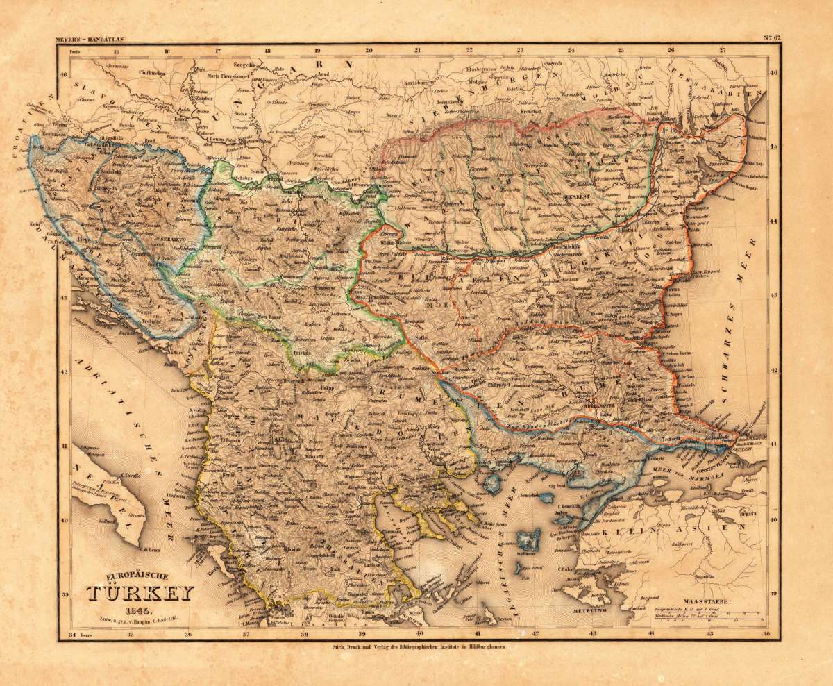
Europäische Türkey 1845. - Entw. u. gez. v. Hauptm. C. Radefeld.
Eigenschaften
- Published: Bibliograph. Institut , Hildburghausen
- Published date: 1845
- Type: Antique Map, map
- Technique: Steel engraving, original color
- Issue date: 1845
- Category: Balkan - European Turkey
- Size: 292 by 355mm (11½ by 14 inches).
- Stock number: 18179
- Condition: In excellent condition.
Article description
Article description
Steel engraving, hand colored in outline when published. Detailed map of the Balkan, called the 'European Turkey' by Hauptmann Radefeld, published in Meyer's Zeitungsatlas around 1845. The detailed map of Southeast Europe is providing a lot of information on the political divisions and borders, as well a lot of information on place names, mountains and rivers.You might also be interested in the following products
 General Karte Des...
 Steel engraving, hand colored in outline, when published. Decorative and interesting map showing the Osman Imperium,...
€75.00
 Turquie...
 Copper engraving, handcolored in outline, when published. Fine and decorative map of Southeast Europe by Robert de...
€195.00
 Die Mitternächtig...
 Copper engraving, hand colored in outline and wash when published in Allain M. Mallet's description of the...
€60.00
 Die europaeische...
 Copper-engraving, handcolored in wash and outline. Small map of Southeast Europe showing mainly the posessions of...
€80.00
Recently viewed products