Schenck Pierre
Le Royaume de Boheme divisée en ses douze cercles Carte Rediute Sur celle de 25 Feuilles par I.C. Muller Capit. et...
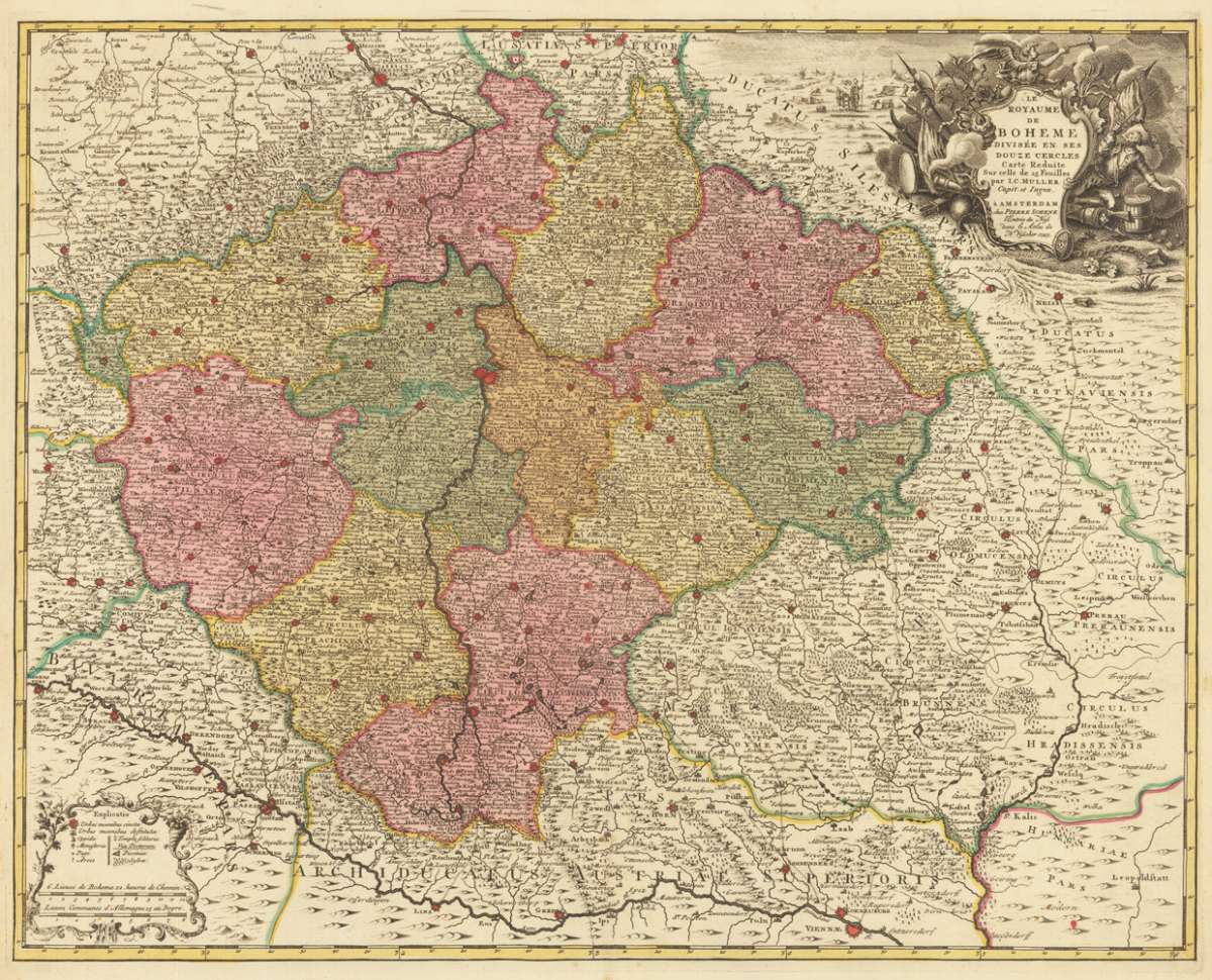
Eigenschaften
- Published: Amsterdam
- Published date: 1745
- Technique: Copper engraving / Original color.
- Issue date: 1745
- Category: Bohemia
- Type: map
- Size: 493 by 623mm (19½ by 24½ inches).
- Stock number: 29715
- Condition: In excellent condition.
Article description
Article description
Copper engraving, hand colored in outline and wash.You might also be interested in the following products
 Marchionatus...
 Original antique copper engraving, hand colored and wash when published. Northern sheet of the district map of...
€150.00
 Marchionatus...
 Original antique copper engraving, hand colored and wash when published. This decorative map shows Moravia in...
€195.00
 Commotau
 Copper engraving, uncolored as published. City view of the city of Commotau in Bohemia, published in the Topographia...
€155.00
 Schlan
 Copper engraving, uncolored as published. City view of the city of Schlan in Bohemia, published in the Topographia...
€125.00
Recently viewed products