Kleinsträtl G. W.
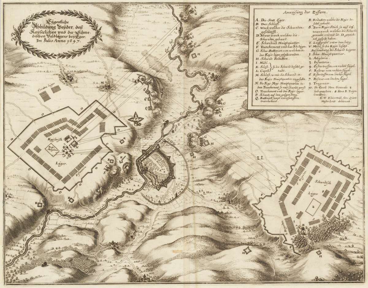
Eigentliche Abbildung beyder des Kayserlichen und der schwedischen Veldlägers bey Eger, im Julio 1647.
- Published date: 1647
- Issue date: 1647
- Technique: Copper engraving
- Type: map
- Category: Eger - Battlemap
- Size: 300 by 385mm (11¾ by 15¼ inches).
- Stock number: 32798
- Condition: In good condition. One wormhole in the center fold.
Article description
Original antique copper engraving, uncolored. The copper engraving shows the landscape around the city of Eger, the river Eger runs across it, the city itself is only schematically sketched on a relatively small scale. The camps of the hostile armies are on both sides of the city. In the top left corner is a short German declaration inscription in a laurel wreath. At the top right is the legend: A – V and 1–10. As soon as the Swedish general Wrangel was protected in the hinterland by the armistice between Maximilian of Bavaria and the Swedes and the French in Ulm in March 1647, he marched with his army to the northeast, conquered Schweinfurt and invaded Bohemia. On June 14, 1647, he besieged the city of Eger, which he declared was the key to Bohemia. In the meantime, a strong imperial army concentrated under the command of General Graf Holzapfel, who was originally called Melander. Even Emperor Ferdinand III. came to Budweis to lend more weight to the prepared combat action. Despite the approaching army, the Swedes were able to capture Eger by chord on July 5. The neutrality of the Elector of Saxony and the ever increasing pressure from the imperial army finally forced Wrangel to leave Bohemia and move through Thuringia to the source area of the Weser.
You might also be interested in the following products
 Marchionatus...
  Marchionatus...
  Commotau
  Schlan