Sanson, Guillaume
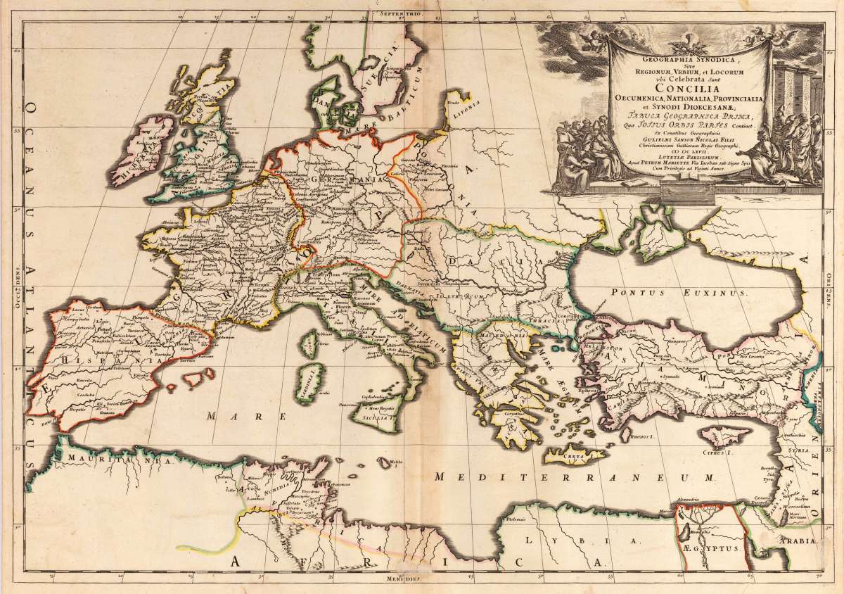
Geographia Synodica, Sive regionum urbium, et locorum ubi celebrata sunt concilia oecumenica, nationalia,...
Eigenschaften
- Published: P. Mariette , Paris
- Published date: 1667
- Technique: Copper engraving / Original color.
- Type: Antique Map, map
- Issue date: 1667
- Size: 395 by 565mm (15½ by 22¼ inches).
- Stock number: 25060
- Condition: The centre fold minor spotting, else in excellent condition.
Article description
Article description
Copper engraving, hand colored in outline when published. A decorative historical map of Europe in original outline color, showing the place names, where Church councils and Synods have been held. Further on the map shows other interesting historical place names, rivers and mountains, also political borders. Decorated with an engraved allegoric title cartouche showing a catholic church council in session. The map covers all of Europe, the Mediterranean and northern Africa. It extends to the eastern Mediterranean with Cyprus and Syria. Guillaume Sanson (1633-1703) was a well known French cartographer. He was the son of Nicolas Sanson. After his father's death in 1667 he worked together with his brother Hubert Jaillot.You might also be interested in the following products
 Carte D'...
 Copper engraving, hand colored in outline when published. This small antique map shows Europe with his countries....
€110.00
 Europa
 Copper engraving, hand colored in outline. Interesting map of Europe probably published by T. Mollo in Vienna....
€110.00


Recently viewed products