Seutter, Matthäus
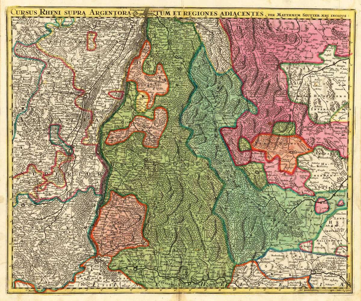
Cursus rheni supra Argentoratum et Regiones Adiacentes, per Matthaeum Seutter aeri incisus:
Cursus rheni supra Argentoratum et Regiones Adiacentes, per Matthaeum Seutter aeri incisus: - Matthäus Seutter ∑ Hand-Colored Original Copperplate Engraving...
Eigenschaften
- Published: Matthaeus Seutter , Augsburg
- Published date: 1720
- Technique: Copper engraving / Original color.
- Type: Antique Map, map
- Issue date: 1720-30
- Category: Breisach and Basel region
- Size: 473 by 575mm (18 by 22 inches).
- Stock number: 22886
- Condition: In excellent condition. A small tear at the right bottom. Not affecting the image. 473 by 575mm (18 by 22 inches).
Article description
Article description
Hand-Colored Original Copperplate Engraving by Matthäus Seutter, depicting Cursus rheni supra Argentoratum et Regiones Adiacentes, per Matthaeum Seutter aeri incisus:. Published Augsburg, Matthaeus Seutter, 1720. Sheet: 473 by 575mm (18 by 22 inches).. A fine and original hand-colored example of Seutter's celebrated cartographic work, documenting this region of Germany with the precision and decorative artistry characteristic of the 17200s. Matthaus Seutter (1678-1757) was one of the most prolific German cartographers of the 18th century, based in Augsburg. He trained as an engraver under Johann Baptist Homann in Nuremberg before establishing his own publishing firm in Augsburg around 1717. His skill and output were so impressive that Holy Roman Emperor Charles VI appointed him Imperial Geographer in 1732 -- a title he shared with his former master Homann. Seutter produced over 500 maps during his career, known for their richly detailed cartouches, decorative borders, and brilliant hand coloring. His work is held in collections at the Augsburg City Library, the Staatsbibliothek Berlin, and major museums across Europe. This original copperplate engraving, with original hand coloring depicts the region of Cursus rheni supra Argentoratum et Regiones Adiacentes, per Matthaeum Seutter aeri incisus:, published in Augsburg, Matthaeus Seutter, 1720-30. The map records the political and geographic boundaries of the region as understood in 1720-30, offering a fascinating window into the history of German territorial organization. Sheet measures 473 by 575mm (18 by 22 inches).. In good condition overall, with minor signs of age appropriate for a 18th-century engraving. Ready to frame.Cursus rheni supra Argentoratum et Regiones Adiacentes, per Matthaeum Seutter aeri incisus: - Matthäus Seutter ∑ Hand-Colored Original Copperplate Engraving...
You might also be interested in the following products
 Württemberg...
 Hand-Colored Original Copperplate Engraving by Petrus Schenk & Gerard Valck, depicting Württemberg Herzogtum....
€450.00
 Circuli Sueviae...
 Hand-Colored Original Copperplate Engraving by Johann Baptist Homann, depicting Circuli Sueviae Mappa ex subsidiis...
€345.00
 Pharus-Plan...
 Original Lithograph by Pharus Verlag, depicting Pharus-Plan Stuttgart. Published Pharus Verlag, Berlin, 1910. Sheet:...
€95.00
 Circulus Suevicus...
 Hand-Colored Original Copperplate Engraving by Matthäus Seutter, depicting Circulus Suevicus in quo Ducatus...
€450.00
Recently viewed products