Riegel, Christoph
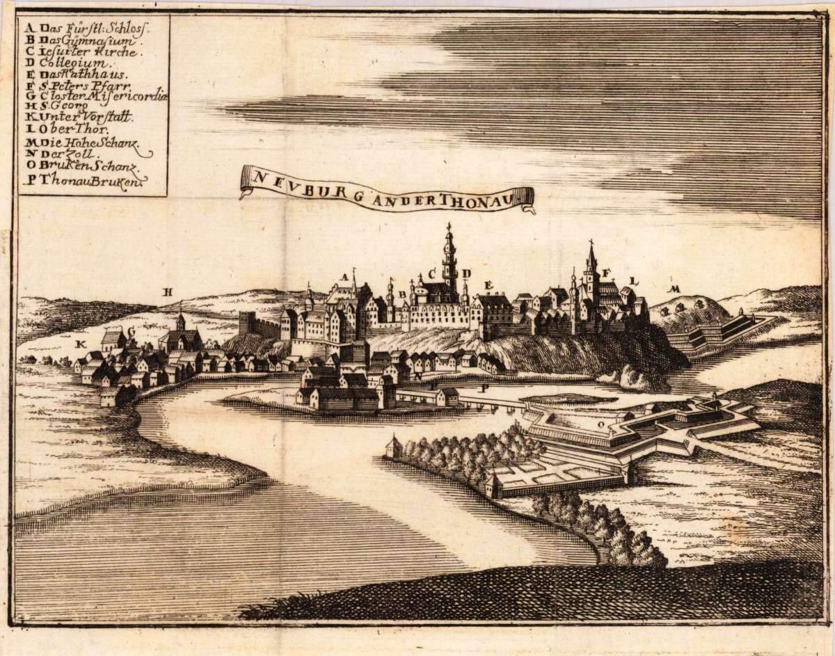
Neuburg an der Thonau
Neuburg an der Thonau - Christoph Riegel ∑ Hand-Colored Original Copperplate Engraving ∑ Frankfurt und Leipzig 1703
Eigenschaften
- Published: Riegel Christoph , Frankfurt und Leipzig
- Published date: 1703
- Type: Antique Map, map
- Technique: Copper engraving / Uncolored
- Category: Neuburg an der Donau
- Issue date: 1703
- Size: 144 by 192mm (5 by 7 inches).
- Stock number: 26336
- Condition: The map was originally published folded, so that the old folds are still slightly visible. Slightly narrow margins as published. In excellent condition. 144 by 192mm (5 by 7 inches).
Article description
Article description
Hand-Colored Original Copperplate Engraving by Christoph Riegel, depicting Neuburg an der Thonau. Published Frankfurt und Leipzig, Riegel Christoph, 1703. Sheet: 144 by 192mm (5 by 7 inches).. A fine and original hand-colored example of Riegel's celebrated cartographic work, documenting this region of Germany with the precision and decorative artistry characteristic of the 17000s. Christoph Riegel was a cartographer active in the 1700s, working in the tradition of European copper-engraved cartography. Their maps are valued by collectors for their historical accuracy and decorative quality. This original copperplate engraving, with original hand coloring depicts the region of Neuburg an der Thonau, published in Frankfurt und Leipzig, Riegel Christoph, 1703. The map records the political and geographic boundaries of the region as understood in 1703, offering a fascinating window into the history of German territorial organization. Sheet measures 144 by 192mm (5 by 7 inches).. In good condition overall, with minor signs of age appropriate for a 18th-century engraving. Ready to frame.Neuburg an der Thonau - Christoph Riegel ∑ Hand-Colored Original Copperplate Engraving ∑ Frankfurt und Leipzig 1703
You might also be interested in the following products
 Mindelheim.
 Hand-Colored Original Copperplate Engraving by Johann Baptist Homann, depicting Mindelheim.. Published Nürnberg,...
€475.00
 Augspurg mit...
 Hand-Colored Original Copperplate Engraving by Christoph Weigel, depicting Augspurg mit umliegender Gegend und dabey...
€195.00
 Circulus...
 Hand-Colored Original Copperplate Engraving by Christoph Weigel, depicting Circulus Franconicus ad Occidentem vergens...
€195.00
 Oberbayern
 Hand-Colored Original Copperplate Engraving by Johann Baptist Homann, depicting Oberbayern. Published Nürnberg,...
€295.00
Recently viewed products