Merian, Matthaeus
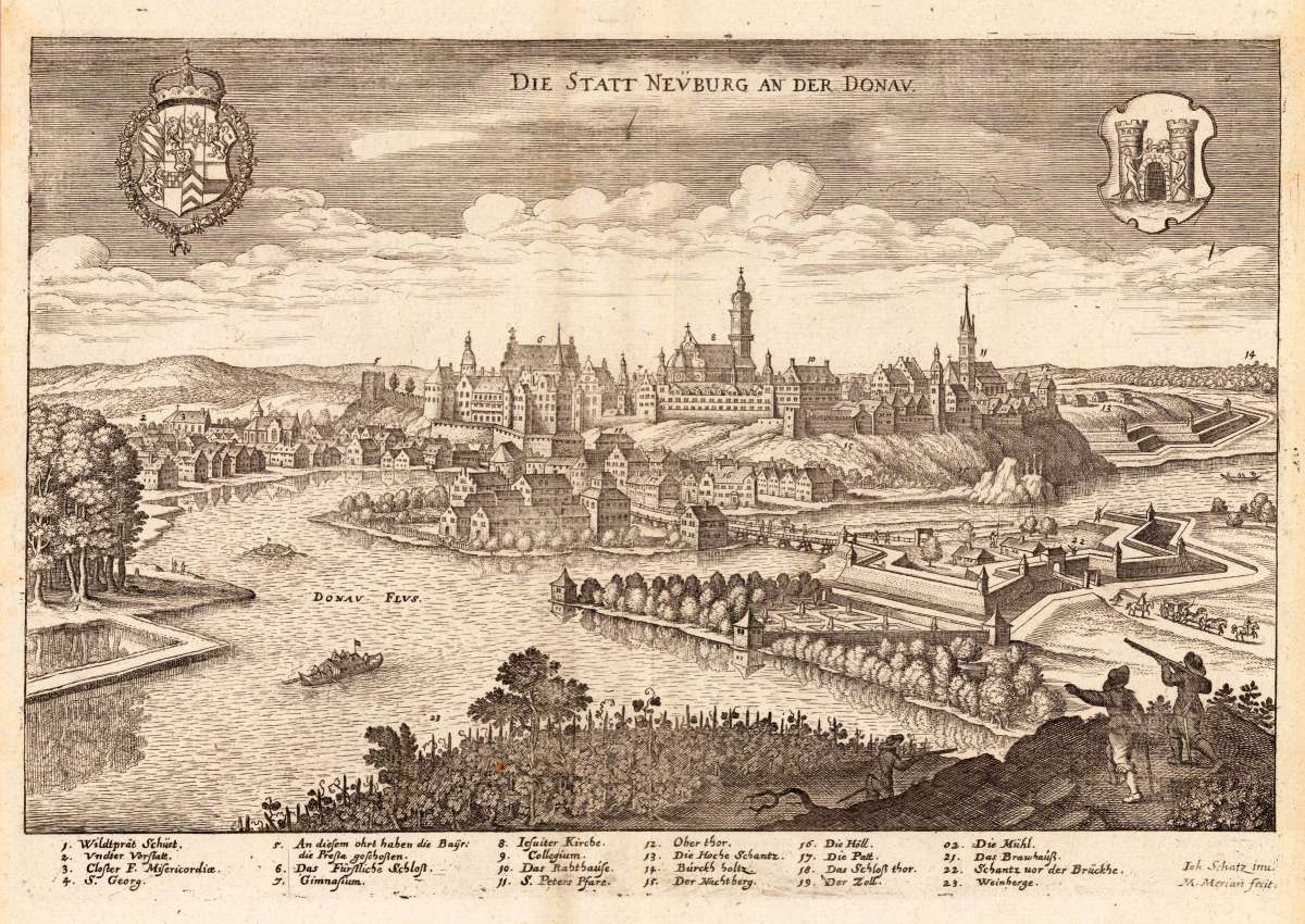
Die Statt Neuburg an der Donau.
Die Statt Neuburg an der Donau. - Matthaeus Merian ∑ Hand-Colored Original Copperplate Engraving ∑ Frankfurt 1644
Eigenschaften
- Published: Matthaeus Merian , Frankfurt
- Published date: 1644
- Type: Antique Map, map
- Technique: Copper engraving / Uncolored
- Category: Neuburg an der Donau
- Issue date: 1644-50
- Size: 248 by 360mm (9 by 14 inches).
- Stock number: 26339
- Condition: The map was originally published folded, so that the old folds are still slightly visible. In excellent condition. 248 by 360mm (9 by 14 inches).
Article description
Article description
Hand-Colored Original Copperplate Engraving by Matthaeus Merian, depicting Die Statt Neuburg an der Donau.. Published Frankfurt, Matthaeus Merian, 1644. Sheet: 248 by 360mm (9 by 14 inches).. A fine and original hand-colored example of Merian's celebrated cartographic work, documenting this region of Germany with the precision and decorative artistry characteristic of the 16400s. Matthaus Merian the Elder (1593-1650) was a Swiss-born engraver and publisher who settled in Frankfurt, where he ran one of the most important printing houses in 17th-century Germany. His greatest work, the Topographia Germaniae (21 volumes, 1642-1654), contained more than 2,000 individual engravings of German cities, towns, fortifications, and landscapes -- the first true visual guidebook to Germany. His views combine scientific topographic accuracy with a theatrical Baroque aesthetic, making them among the most desirable of all 17th-century topographic prints. Merian's work is held in major collections including the Stadel Museum Frankfurt, the Germanisches Nationalmuseum Nuremberg, and the British Library. This original copperplate engraving, with original hand coloring depicts the region of Die Statt Neuburg an der Donau., published in Frankfurt, Matthaeus Merian, 1644-50. The map records the political and geographic boundaries of the region as understood in 1644-50, offering a fascinating window into the history of German territorial organization. Sheet measures 248 by 360mm (9 by 14 inches).. In good condition overall, with minor signs of age appropriate for a 17th-century engraving. Ready to frame.Die Statt Neuburg an der Donau. - Matthaeus Merian ∑ Hand-Colored Original Copperplate Engraving ∑ Frankfurt 1644
You might also be interested in the following products
 Mindelheim.
 Hand-Colored Original Copperplate Engraving by Johann Baptist Homann, depicting Mindelheim.. Published Nürnberg,...
€475.00
 Augspurg mit...
 Hand-Colored Original Copperplate Engraving by Christoph Weigel, depicting Augspurg mit umliegender Gegend und dabey...
€195.00
 Circulus...
 Hand-Colored Original Copperplate Engraving by Christoph Weigel, depicting Circulus Franconicus ad Occidentem vergens...
€195.00
 Oberbayern
 Hand-Colored Original Copperplate Engraving by Johann Baptist Homann, depicting Oberbayern. Published Nürnberg,...
€295.00
Recently viewed products