Hondius, Hendrik & Mercator, Gerard
Oberbayern
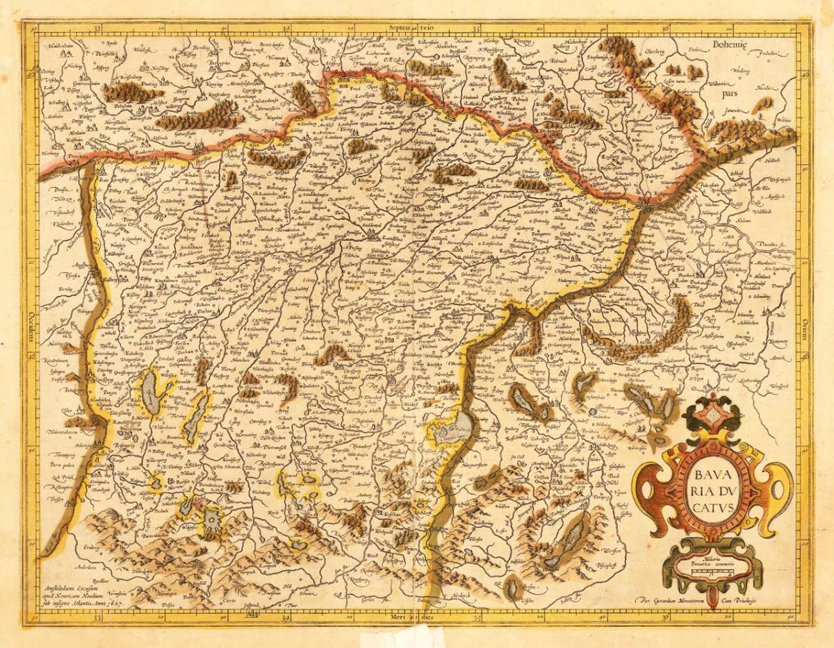
Oberbayern - Hendrik Hondius & Gerard Mercator ∑ Hand-Colored Original Copperplate Engraving ∑ Amsterdam 1627
Eigenschaften
- Published: Hendrik Hondius & Gerard Mercator , Amsterdam
- Published date: 1627
- Type: Antique Map, map
- Issue date: 1627
- Technique: Copper engraving / Original color
- Category: Oberbayern
- Size: 365 by 480mm (14 by 19 inches).
- Stock number: 28529
- Condition: At the lower centre fold outside the image of the map, a larger mending (paper pasted over) is visible, otherwise in good condition. 365 by 480mm (14 by 19 inches).
Article description
Article description
Hand-Colored Original Copperplate Engraving by Hendrik Hondius & Gerard Mercator, depicting Oberbayern. Published Amsterdam, Hendrik Hondius & Gerard Mercator, 1627. Sheet: 365 by 480mm (14 by 19 inches).. A fine and original hand-colored example of Hondius's celebrated cartographic work, documenting this region of Germany with the precision and decorative artistry characteristic of the 16200s. Gerardus Mercator (1512-1594) was the greatest cartographer of the 16th century. Born in Flanders, he invented the Mercator projection in 1569 -- a revolutionary cylindrical map projection still used in nautical charts today. He was the first to use the word 'atlas' for a collection of maps, honouring the Titan who held up the world. His 1585 atlas of France, Germany, and the Low Countries was the first in a series that would be completed and republished by his heirs and successors, most notably Hondius and Janssonius. Mercator maps are prized by collectors for their historical importance and elegant Renaissance engraving, and are held in leading institutions including the BibliothËque nationale de France and the British Library. This original copperplate engraving, with original hand coloring depicts the region of Oberbayern, published in Amsterdam, Hendrik Hondius & Gerard Mercator, 1627. The map features a decorative Baroque cartouche containing the title inscription. The map records the political and geographic boundaries of the region as understood in 1627, offering a fascinating window into the history of German territorial organization. Sheet measures 365 by 480mm (14 by 19 inches).. In good condition overall, with minor signs of age appropriate for a 17th-century engraving. Ready to frame.Oberbayern - Hendrik Hondius & Gerard Mercator ∑ Hand-Colored Original Copperplate Engraving ∑ Amsterdam 1627
You might also be interested in the following products
 Mindelheim.
 Hand-Colored Original Copperplate Engraving by Johann Baptist Homann, depicting Mindelheim.. Published Nürnberg,...
€475.00
 Augspurg mit...
 Hand-Colored Original Copperplate Engraving by Christoph Weigel, depicting Augspurg mit umliegender Gegend und dabey...
€195.00
 Circulus...
 Hand-Colored Original Copperplate Engraving by Christoph Weigel, depicting Circulus Franconicus ad Occidentem vergens...
€195.00
 Oberbayern
 Hand-Colored Original Copperplate Engraving by Johann Baptist Homann, depicting Oberbayern. Published Nürnberg,...
€295.00
Recently viewed products