Zatta, Antonio
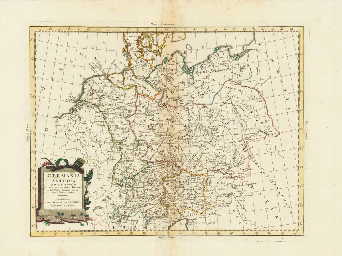
Germania Antiqua in IV magnos populos in minores et minimos distincta et Regiones Danubium inter et mare Adriaticum...
Germania Antiqua in IV magnos populos in minores et minimos distincta et Regiones Danubium inter et mare Adriaticum contentae. - Venetiis 1785. Apud Antonium...
Eigenschaften
- Published: Venice
- Published date: 1785
- Technique: Copper engraving / Original color.
- Issue date: 1785
- Category: Germania Antiqua
- Type: map
- Size: 303 by 396mm (12 by 15 inches).
- Stock number: 28179
- Condition: In excellent condition.
Article description
Article description
Original Copperplate Engraving by Antonio Zatta, depicting Germania Antiqua in IV magnos populos in minores et minimos distincta et Regiones Danubium inter et mare Adriaticum contentae. - Venetiis 1785. Apud Antonium Zatta et Figlios cum Privil. Excel. Sen.. Published Venice, Antonio Zatta, 1785. Sheet: 303 by 396mm (12 by 15 inches).. A fine and example of Zatta's celebrated cartographic work, documenting this region of Germany with the precision and decorative artistry characteristic of the 17800s. Antonio Zatta (c.1722-1797) was a Venetian cartographer and publisher who produced an important series of maps of world regions during the 1770s-1790s. Published in Venice, his maps are distinguished by their elegant rococo cartouches, clear engraving style, and characteristic Italian sensibility. His Atlas Novissimo series (1775-1785) covered territories across Europe and beyond, and is considered one of the finest Italian cartographic productions of the 18th century. This original copperplate engraving depicts the region of Germania Antiqua in IV magnos populos in minores et minimos distincta et Regiones Danubium inter et mare Adriaticum contentae. - Venetiis 1785. Apud Antonium Zatta et Figlios cum Privil. Excel. Sen., published in Venice, Antonio Zatta, 1785. The map records the political and geographic boundaries of the region as understood in 1785, offering a fascinating window into the history of German territorial organization. Sheet measures 303 by 396mm (12 by 15 inches).. In good condition, showing expected signs of age. Ready to frame.Germania Antiqua in IV magnos populos in minores et minimos distincta et Regiones Danubium inter et mare Adriaticum contentae. - Venetiis 1785. Apud Antonium...
You might also be interested in the following products
 Trier - Koblentz...
 Hand-Colored Original Copperplate Engraving by Georg Braun & Franz Hogenberg, depicting Trier - Koblentz -...
€595.00
 Neus
Neus Hand-Colored Original Copperplate Engraving by Georg Braun & Franz Hogenberg, depicting Neus. Published Cologne,...
€745.00
 Campidonia vulgo...
 Hand-Colored Original Copperplate Engraving by Georg Braun & Franz Hogenberg, depicting Campidonia vulgo...
€850.00
 Novesium vulgo...
 Hand-Colored Original Copperplate Engraving by Georg Braun & Franz Hogenberg, depicting Novesium vulgo Neus; urbs...
€800.00
Recently viewed products