Homann, J.B. (Homann Heirs)
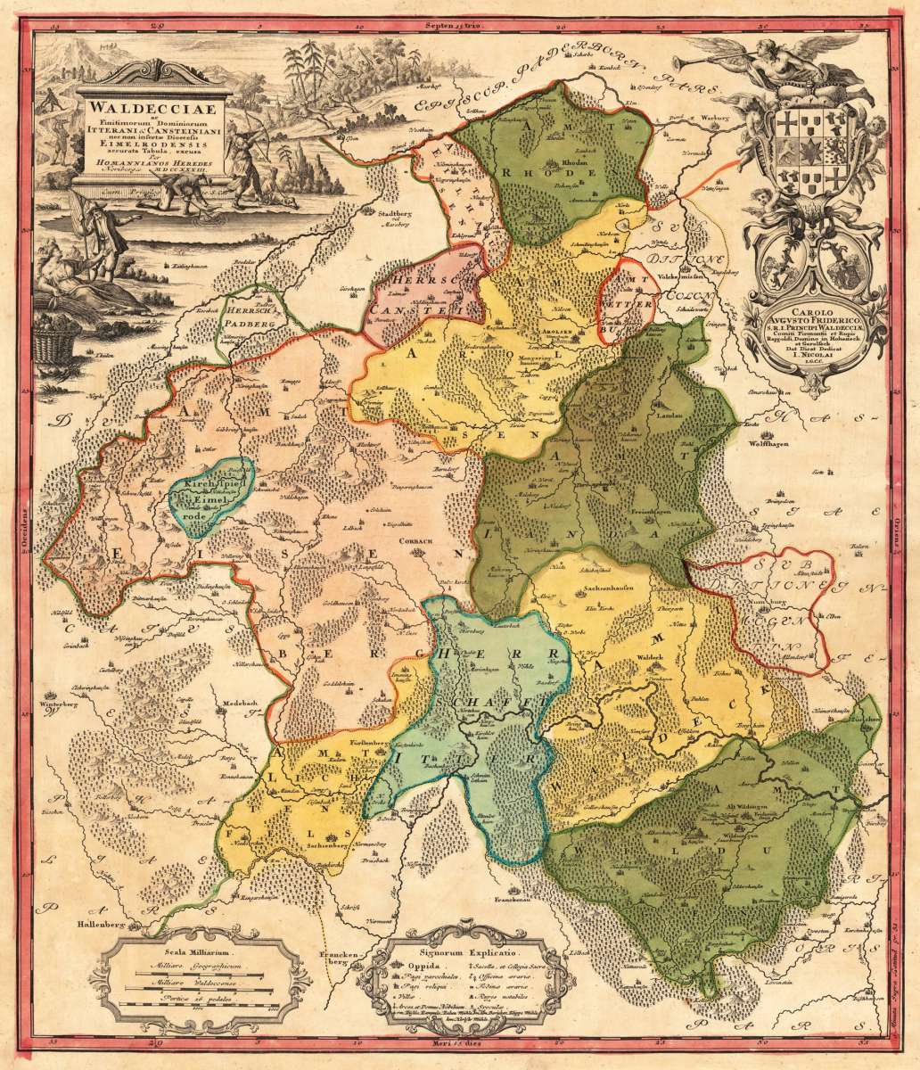
Waldecciae ac Finitimorum Itterani & Cansteiniani nee non insertae Dioecesis Eimelrodensis accurata Tabula, excusa...
Waldecciae ac Finitimorum Itterani & Cansteiniani nee non insertae Dioecesis Eimelrodensis accurata Tabula, excusa Per Homannianos Heredes Noribergae MDCCXXX...
Eigenschaften
- Published: Homann , Nürnberg
- Published date: 1733
- Technique: Copper engraving / Original color.
- Type: Antique Map, map
- Category: Waldeck
- Issue date: 1733
- Size: 555 by 478mm (21 by 18 inches).
- Stock number: 20511
- Condition: A small carefully mended tear in the left blank margin. Still in excellent condition. Published plano without a centre fold. 555 by 478mm (21 by 18 inches).
Article description
Article description
Hand-Colored Original Copperplate Engraving by J.B. (Homann Heirs) Homann, depicting Waldecciae ac Finitimorum Itterani & Cansteiniani nee non insertae Dioecesis Eimelrodensis accurata Tabula, excusa Per Homannianos Heredes Noribergae MDCCXXXIII,. Published Nürnberg, Homann, 1733. Sheet: 555 by 478mm (21 by 18 inches).. A fine and original hand-colored example of Homann's celebrated cartographic work, documenting this region of Germany with the precision and decorative artistry characteristic of the 17300s. Johann Baptist Homann (1664-1724) was the foremost map publisher of 18th-century Germany. Born in Bavaria, he founded his cartographic publishing house in Nuremberg in 1702 and within a decade had become the dominant force in German-language cartography. In 1715, Holy Roman Emperor Charles VI appointed him Imperial Cartographer -- a prestigious title that gave Homann access to the most current geographic data and exclusive publishing privileges. His maps are celebrated for their bold copper engraving, elaborate Baroque cartouches, and vivid original hand coloring. Following Homann's death in 1724, the firm continued under the imprint 'Homann Heirs' (Homannsche Erben). His maps are held in major collections worldwide, including the Library of Congress, the British Library, and the Bayerische Staatsbibliothek. This original copperplate engraving, with original hand coloring depicts the region of Waldecciae ac Finitimorum Itterani & Cansteiniani nee non insertae Dioecesis Eimelrodensis accurata Tabula, excusa Per Homannianos Heredes Noribergae MDCCXXXIII,, published in Nürnberg, Homann, 1733. The map records the political and geographic boundaries of the region as understood in 1733, offering a fascinating window into the history of German territorial organization. Sheet measures 555 by 478mm (21 by 18 inches).. In good condition overall, with minor signs of age appropriate for a 18th-century engraving. Ready to frame.Waldecciae ac Finitimorum Itterani & Cansteiniani nee non insertae Dioecesis Eimelrodensis accurata Tabula, excusa Per Homannianos Heredes Noribergae MDCCXXX...
You might also be interested in the following products
 Hassia Landgraviatus
 Hand-Colored Original Copperplate Engraving by Gerard Mercator, depicting Hassia Landgraviatus. Published Amsterdam,...
€145.00
 Nassovia Comitatus.
 Hand-Colored Original Copperplate Engraving by Gerard Mercator, depicting Nassovia Comitatus.. Published Amsterdam,...
€145.00
 Waldeck Comitatus.
 Hand-Colored Original Copperplate Engraving by Gerard Mercator, depicting Waldeck Comitatus.. Published Amsterdam,...
€145.00
 Li Circoli dell...
 Original Copperplate Engraving by Antonio Zatta, depicting Li Circoli dell Alto, e Basso Reno Di Nouva Projezione -...
€85.00
Recently viewed products