Seutter, Matthäus
Ducatus Luneburgicus cum Comitatu Dannebergensi juxta Praefecturas suas accurrate designatus et mappa Geographica...
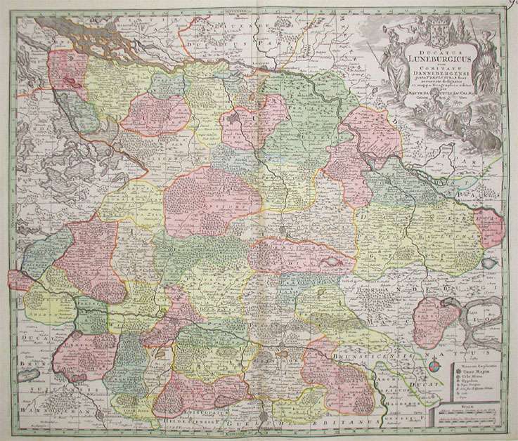
Ducatus Luneburgicus cum Comitatu Dannebergensi juxta Praefecturas suas accurrate designatus et mappa Geographica editus per Matth. Seutter Sac. Caes. Maj. G...
Eigenschaften
- Published: M. Seutter , Augsburg
- Published date: 1741
- Technique: Copper engraving / Original color.
- Type: Antique Map, map
- Issue date: 1741
- Category: Lüneburg
- Size: 505 by 585mm (20 by 23 inches).
- Stock number: 17364
- Condition: Carefully mended split at the upper centrefold, within the image, else in very good condition. 505 by 585mm (20 by 23 inches).
Article description
Article description
Hand-Colored Original Copperplate Engraving by Matthäus Seutter, depicting Ducatus Luneburgicus cum Comitatu Dannebergensi juxta Praefecturas suas accurrate designatus et mappa Geographica editus per Matth. Seutter Sac. Caes. Maj. Geogr. Aug. Vind.. Published Augsburg, M. Seutter, 1741. Sheet: 505 by 585mm (20 by 23 inches).. A fine and original hand-colored example of Seutter's celebrated cartographic work, documenting this region of Germany with the precision and decorative artistry characteristic of the 17400s. Matthaus Seutter (1678-1757) was one of the most prolific German cartographers of the 18th century, based in Augsburg. He trained as an engraver under Johann Baptist Homann in Nuremberg before establishing his own publishing firm in Augsburg around 1717. His skill and output were so impressive that Holy Roman Emperor Charles VI appointed him Imperial Geographer in 1732 -- a title he shared with his former master Homann. Seutter produced over 500 maps during his career, known for their richly detailed cartouches, decorative borders, and brilliant hand coloring. His work is held in collections at the Augsburg City Library, the Staatsbibliothek Berlin, and major museums across Europe. This original copperplate engraving, with original hand coloring depicts the region of Ducatus Luneburgicus cum Comitatu Dannebergensi juxta Praefecturas suas accurrate designatus et mappa Geographica editus per Matth. Seutter Sac. Caes. Maj. Geogr. Aug. Vind., published in Augsburg, M. Seutter, 1741. The map records the political and geographic boundaries of the region as understood in 1741, offering a fascinating window into the history of German territorial organization. Sheet measures 505 by 585mm (20 by 23 inches).. In good condition overall, with minor signs of age appropriate for a 18th-century engraving. Ready to frame.Ducatus Luneburgicus cum Comitatu Dannebergensi juxta Praefecturas suas accurrate designatus et mappa Geographica editus per Matth. Seutter Sac. Caes. Maj. G...
You might also be interested in the following products
 Niedersachsen
 Hand-Colored Original Copperplate Engraving by Gerard Mercator, depicting Niedersachsen. Published Amsterdam, Jodocus...
€300.00
 Episcopatuum...
 Hand-Colored Original Copperplate Engraving by Matthäus Seutter, depicting Episcopatuum Monasteriensis Et...
€495.00
 Saxoniae...
 Hand-Colored Original Copperplate Engraving by Matthäus Seutter, depicting Saxoniae Inferioris Circulus juxta...
€300.00
 Ducatus...
 Hand-Colored Original Copperplate Engraving by Johann Baptist Homann, depicting Ducatus Brunsuicensis in ejusdem tres...
€300.00
Recently viewed products