Homann, Johann Baptist
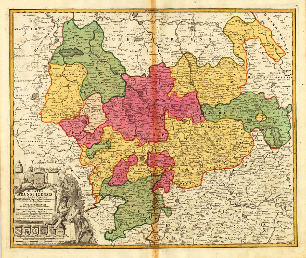
Ducatus Brunsuicensis in ejusdem tres Principatus Calenbergicu seilicet & Grubenhagense (sub Duce Br. Lun....
Ducatus Brunsuicensis in ejusdem tres Principatus Calenbergicu seilicet & Grubenhagense (sub Duce Br. Lun. Hannoveriano) et in Guelpherbitanum (sub Duce Br....
Eigenschaften
- Published: Homann , Nürnberg
- Published date: 1740
- Technique: Copper engraving / Original color.
- Type: Antique Map, map
- Issue date: 1740
- Category: Braunschweig
- Size: 482 by 575mm (19 by 22 inches).
- Stock number: 17365
- Condition: In very good condition. 482 by 575mm (19 by 22 inches).
Article description
Article description
Hand-Colored Original Copperplate Engraving by Johann Baptist Homann, depicting Ducatus Brunsuicensis in ejusdem tres Principatus Calenbergicu seilicet & Grubenhagense (sub Duce Br. Lun. Hannoveriano) et in Guelpherbitanum (sub Duce Br. Lun. Guelpherbitano) distincte divisi, nec non Episcopatus Hildesiensis, Principatus Halberstadiensis et Comitatuum Schawenburg, Hohenstein, Rheinstein, Blankenberg, Stolberg et Wernigerodae accurata Tabula edita operâ et Sumtibus Ioh. Bapt. Homanni Norimbergae.. Published Nürnberg, Homann, 1740. Sheet: 482 by 575mm (19 by 22 inches).. A fine and original hand-colored example of Homann's celebrated cartographic work, documenting this region of Germany with the precision and decorative artistry characteristic of the 17400s. Johann Baptist Homann (1664-1724) was the foremost map publisher of 18th-century Germany. Born in Bavaria, he founded his cartographic publishing house in Nuremberg in 1702 and within a decade had become the dominant force in German-language cartography. In 1715, Holy Roman Emperor Charles VI appointed him Imperial Cartographer -- a prestigious title that gave Homann access to the most current geographic data and exclusive publishing privileges. His maps are celebrated for their bold copper engraving, elaborate Baroque cartouches, and vivid original hand coloring. Following Homann's death in 1724, the firm continued under the imprint 'Homann Heirs' (Homannsche Erben). His maps are held in major collections worldwide, including the Library of Congress, the British Library, and the Bayerische Staatsbibliothek. This original copperplate engraving, with original hand coloring depicts the region of Ducatus Brunsuicensis in ejusdem tres Principatus Calenbergicu seilicet & Grubenhagense (sub Duce Br. Lun. Hannoveriano) et in Guelpherbitanum (sub Duce Br. Lun. Guelpherbitano) distincte divisi, nec non Episcopatus Hildesiensis, Principatus Halberstadiensis et Comitatuum Schawenburg, Hohenstein, Rheinstein, Blankenberg, Stolberg et Wernigerodae accurata Tabula edita operâ et Sumtibus Ioh. Bapt. Homanni Norimbergae., published in Nürnberg, Homann, 1740. The map features a decorative Baroque cartouche containing the title inscription. The cartouche is elaborated with allegorical or figural ornamentation. The map records the political and geographic boundaries of the region as understood in 1740, offering a fascinating window into the history of German territorial organization. Sheet measures 482 by 575mm (19 by 22 inches).. In good condition overall, with minor signs of age appropriate for a 18th-century engraving. Ready to frame.Ducatus Brunsuicensis in ejusdem tres Principatus Calenbergicu seilicet & Grubenhagense (sub Duce Br. Lun. Hannoveriano) et in Guelpherbitanum (sub Duce Br....
You might also be interested in the following products
 Niedersachsen
 Hand-Colored Original Copperplate Engraving by Gerard Mercator, depicting Niedersachsen. Published Amsterdam, Jodocus...
€300.00
 Episcopatuum...
 Hand-Colored Original Copperplate Engraving by Matthäus Seutter, depicting Episcopatuum Monasteriensis Et...
€495.00
 Saxoniae...
 Hand-Colored Original Copperplate Engraving by Matthäus Seutter, depicting Saxoniae Inferioris Circulus juxta...
€300.00
 Ducatus...
 Hand-Colored Original Copperplate Engraving by Matthäus Seutter, depicting Ducatus Luneburgicus cum Comitatu...
€275.00
Recently viewed products