Blaeu, Guijelmus & Joan.
Braunschweig
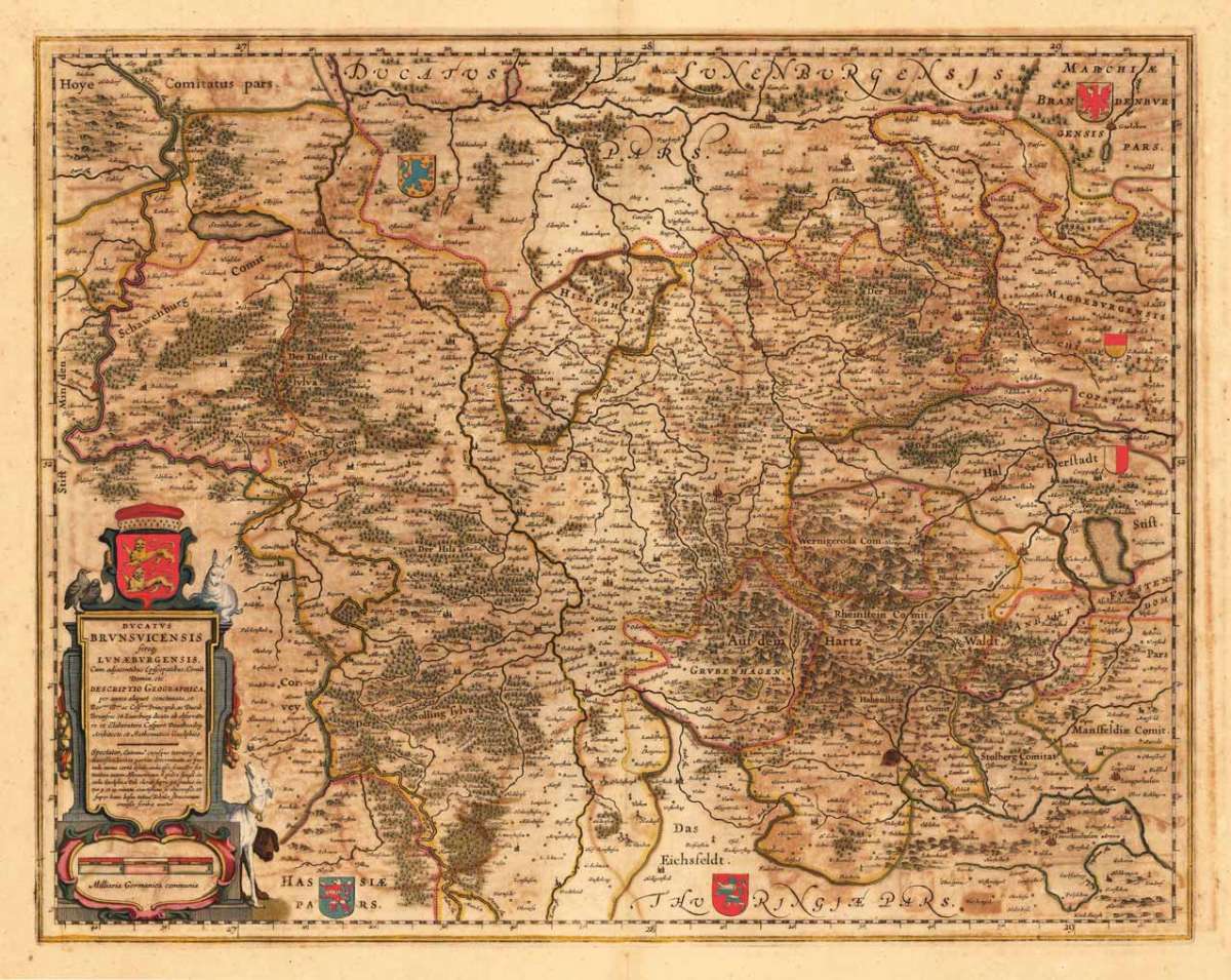
Braunschweig - Guijelmus Blaeu & Joan. ∑ Hand-Colored Original Copperplate Engraving ∑ Amsterdam 1640
Eigenschaften
- Published: Joan. & Guilejemus Blaeu , Amsterdam
- Published date: 1640
- Technique: Copper engraving / Original color.
- Type: Antique Map, map
- Category: Niedersachsen
- Issue date: 1640/50
- Size: 415 by 527mm (16 by 20 inches).
- Stock number: 23207
- Condition: In gutem Erhaltungszustand. 415 by 527mm (16 by 20 inches).
Article description
Article description
Hand-Colored Original Copperplate Engraving by Guijelmus Blaeu & Joan., depicting Braunschweig. Published Amsterdam, Joan. & Guilejemus Blaeu, 1640. Sheet: 415 by 527mm (16 by 20 inches).. A fine and original hand-colored example of Blaeu's celebrated cartographic work, documenting this region of Germany with the precision and decorative artistry characteristic of the 16400s. Willem Blaeu (1571-1638) and his son Joan Blaeu (1596-1673) presided over the greatest cartographic publishing house of the Dutch Golden Age. Based in Amsterdam, the Blaeu firm was the official cartographer to the Dutch East India Company (VOC). Joan's monumental Atlas Maior (1662), in eleven volumes with 600 maps, was the most expensive book of the 17th century and the ultimate status symbol of the age. Blaeu maps are renowned for their exceptional quality, rich hand coloring, and sumptuous decorative borders. They are held in premier collections including the BibliothËque nationale de France, the Library of Congress, and the Nationaal Archief in The Hague. This original copperplate engraving, with original hand coloring depicts the region of Braunschweig, published in Amsterdam, Joan. & Guilejemus Blaeu, 1640/50. The map features a decorative Baroque cartouche containing the title inscription. A distance scale is incorporated within the cartouche or alongside it. Coats of arms of the relevant territories are displayed. The map records the political and geographic boundaries of the region as understood in 1640/50, offering a fascinating window into the history of German territorial organization. Sheet measures 415 by 527mm (16 by 20 inches).. In good condition overall, with minor signs of age appropriate for a 17th-century engraving. Ready to frame.Braunschweig - Guijelmus Blaeu & Joan. ∑ Hand-Colored Original Copperplate Engraving ∑ Amsterdam 1640
You might also be interested in the following products
 Niedersachsen
 Hand-Colored Original Copperplate Engraving by Gerard Mercator, depicting Niedersachsen. Published Amsterdam, Jodocus...
€300.00
 Episcopatuum...
 Hand-Colored Original Copperplate Engraving by Matthäus Seutter, depicting Episcopatuum Monasteriensis Et...
€495.00
 Saxoniae...
 Hand-Colored Original Copperplate Engraving by Matthäus Seutter, depicting Saxoniae Inferioris Circulus juxta...
€300.00
 Ducatus...
 Hand-Colored Original Copperplate Engraving by Matthäus Seutter, depicting Ducatus Luneburgicus cum Comitatu...
€275.00
Recently viewed products