Koehler, A.H.
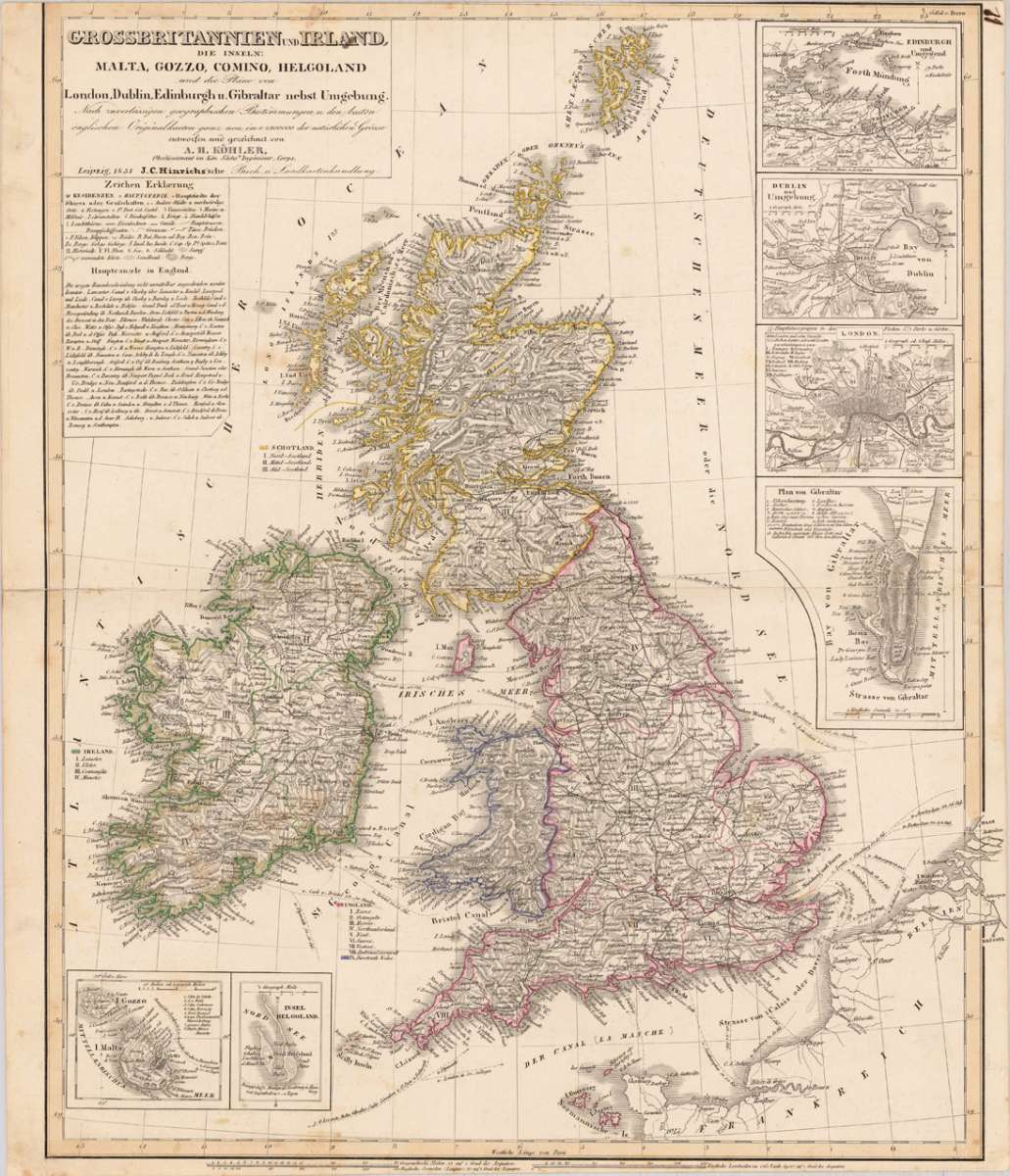
Grossbritannien und Ireland, die Inseln: Malta, Gozzo, Comino, Helgoland und die pläne von London, Dublin, Edinburgh...
€95.00
Prices incl. VAT plus shipping costs
This item is sold. Please contact us if you are searching for this item.
Eigenschaften
- Published: Hinrich J.C. , Leipzig
- Published date: 1851
- Type: Antique Map, map
- Technique: Steel engraving, original color
- Issue date: 1851
- Category: British Isles
- Size: 485 by 393mm (19 by 15½ inches).
- Stock number: 17480
- Condition: In good condition, two old mendings of clear splits at the centerfold. Upper margin slightly narrow the the engraved border line of the map.
Article description
Article description
Steelengraving, handcolored in outline, when published. Decorative map of British Isles additional equipped with for inset maps and plans: Edinburgh, Dublin, London & Gibraltar. As North Helgoland & Malta. In addition we find a detailled table with explanations on villages and names, as well a listing of the main channels in England. A color key for the political borders is also present.You might also be interested in the following products
 Li Regni D'...
 Copper engraving, in contemporary original color in outline. Published in Zatta's "Atlante Novissimo"....
€245.00
 Neueste Karte von...
 Steelengraving, handcolored in outline when published. Detailled map of Great Britain and Ireland with many...
€80.00
 General Carte von...
 Original antique copper engraving, hand colored in outline and wash, when published. Detailled map of the British...
€195.00
 Carte des Grandes...
 Copper-engraving, handcolored in outline, when published. Detailed map by the French cartographer Sr. Robert de...
€350.00
Recently viewed products