Mollo, Tranquillo
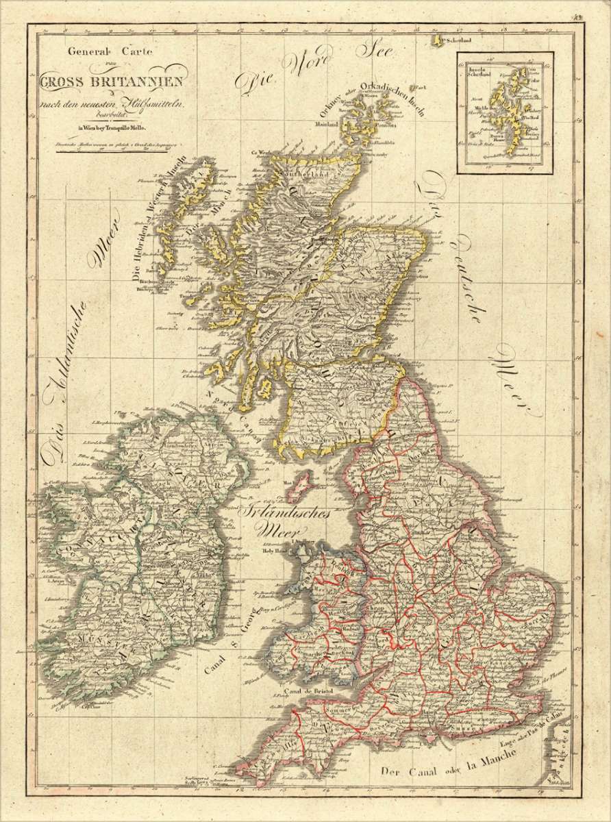
General Carte von Gross Britannien nach den neuesten Hülfsmitteln bearbeitet. in Wien bey Tranquillo Mollo
Eigenschaften
- Published: Mollo , Vienna
- Published date: 1807
- Technique: Copper engraving / Original color.
- Type: Antique Map, map
- Issue date: 1807.
- Category: British Isles
- Size: 456 by 330mm (18 by 13 inches).
- Stock number: 17455
- Condition: In excellent condition. 456 by 330mm (18 by 13 inches).
Article description
Article description
Original antique copper engraving, hand colored in outline and wash, when published. Detailled map of the British Isles (Ireland, Scotland and England). With many engraved names of cities, villages and smaller places. A good map of the British Isles after the newest cartographic scources in Vienna published. In the upper right corner a small inset map of the Shetland islands. The British Isles are divided up in political regions with outline and body colors. Moreover the various kingdoms are additional equipped with information of the various counties. Streets, rivers, mountains and many small cities and villages are engraved. Tranquillo Maria Laurentio Mollo (August 10, 1767 - March 29, 1837) was Vienna based Swiss/Italian graphic designer, printer, art and music dealer, and publisher active in the late 18th and early 20th centuries. From about 1792 Mollo worked with the Vienna firm Artaria and Company. In 1798 he separated from Artaria to found, along with partner Franz Bernardini, his own music, art, and map publishing company, T. Mollo and Co. The partner collapsed after one year and Mollo took a new partner, Domenico Artaria, a scion of the Artaria family. In 1802 Mollo and Domenico acquired Artaria and Company from Carlo Artaria. Domenico and Mollo parted ways in 1804, after which Mollo published independently. Under his own imprint, he became one of Austria's most important globe and map publishers. He collaborated extensively with English and French publishers to bring French material to his work. Among his more significant collaborators was the Vienna publisher Joseph Dirwaldt. In 1832 Mollo passed the company to his sons, Eduard (1799-1842) and Florian Mollo (1803-1869). The Mollo brothers ran the business until 1839, three years after Tranquillo Mollo's death, before dividing the concern into separate business. Mollo married Dorothea Defelavis († 29. Juli 1822). (Wikipedia)You might also be interested in the following products
 Li Regni D'...
 Copper engraving, in contemporary original color in outline. Published in Zatta's "Atlante Novissimo"....
€245.00
 Neueste Karte von...
 Steelengraving, handcolored in outline when published. Detailled map of Great Britain and Ireland with many...
€80.00
 Carte des Grandes...
 Copper-engraving, handcolored in outline, when published. Detailed map by the French cartographer Sr. Robert de...
€350.00
 Neueste Karte von...
 Steelengraving, handcolored in outline when published. Detailled map of Great Britain and Ireland with many...
€80.00
Recently viewed products