Homann, Johann Baptist
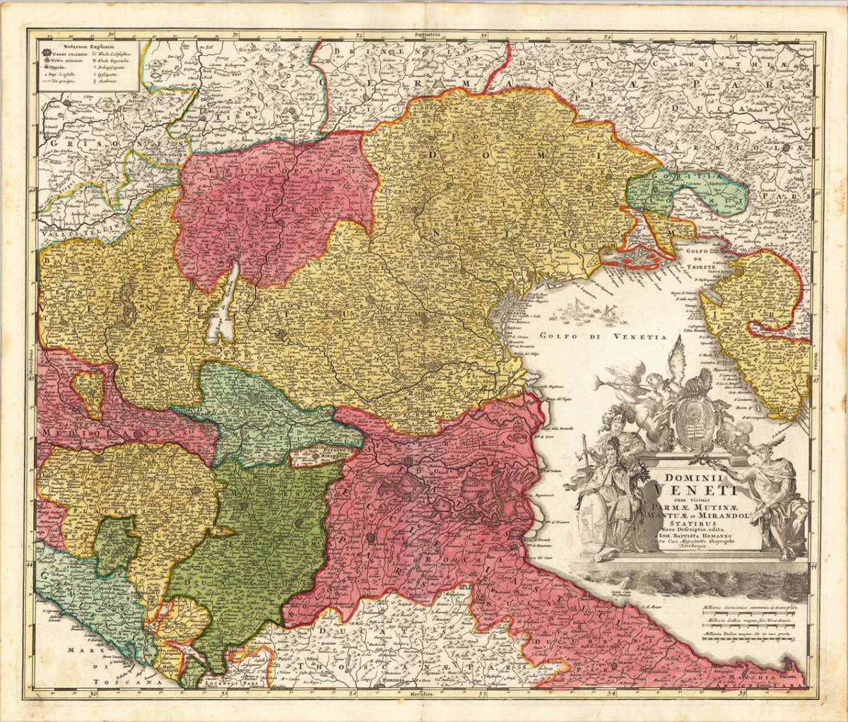
Dominii Veneti cum vicinis Parmae Mutinae Mantuae et Mirandol - Statibus Nova Deseriptio, edita a Ioh. Baptista....
Homann, Johann – Mantua · Copper Engraving, Hand Colored · Grosser Atlas, Nuremberg · 1720
Eigenschaften
- Published: Homann , Nürnberg
- Published date: 1720
- Type: Antique Map, map
- Technique: Copper engraving / handcolored.
- Issue date: 1720-30
- Category: Northern Italy
- Size: 488 by 584mm (19 by 23 inches).
- Stock number: 18261
- Condition: In very good condition. 488 by 584mm (19 by 23 inches).
Article description
Article description
Original antique hand-colored copper engraving, from the Homann atlas, published in Nuremberg, 1720. Depicting Mantua, this map is a fine example of 1720s European cartography. Image: 488 by 584mm (19 by 23 inches). An attractive and historically significant 18th-century map for the discerning collector. Johann Baptist Homann (1664–1724) was the most important German cartographer and publisher of the early 18th century. Born in Bavaria, he founded his cartographic publishing house in Nuremberg in 1702, which rapidly became the leading German map publisher. In 1715, Emperor Charles VI appointed him Imperial Geographer (Kayserlicher Geographus), the highest cartographic honor in the Holy Roman Empire. Homann's maps are known for their superb copper engraving, rich hand coloring, and elaborate allegorical cartouches featuring figures, coats of arms, and historical vignettes. After his death in 1724, the firm continued as 'Homann Erben' (Homann's Heirs) and published maps well into the 19th century. Homann maps are held at the Germanisches Nationalmuseum in Nuremberg and major international institutions. A fine impression of this decorative map of Italy. With many engraved place-names, rivers, lakes and mountains. At the right lower corner is a allegoric figurative cartouche, in the lower right corner a small milage-scale. A fine example from Grosser Atlas, Nuremberg, sought after by collectors of antique maps of Italy, antique maps of Mantua, and antique hand-colored copper engravings for sale. In very good condition. Light age-toning to the sheet, as expected for a 18th-century map.Homann, Johann – Mantua · Copper Engraving, Hand Colored · Grosser Atlas, Nuremberg · 1720
You might also be interested in the following products
 Moluccae Insulae...
 Original antique copper engraving, hand colored in outline and wash when published. A highly decorative map of the...
€550.00
 Pascaert van...
 Original antique copper engraving, uncolored as published. Detailed chart of the Northeastern part of Canada,...
€1,750.00
 Pascaarte vande...
 Copper Engraving, uncolored by van Keulen, Joan, published 1684-1704 by Johannes van Keulen, Amsterdam. Image size:...
€1,100.00
 Pedemontanae...
 Original antique copper engraving, uncolored, from the 'Theatrum Orbis Terrarum' by Abraham Ortelius, the...
€650.00
Recently viewed products