Janssonius, Joan.
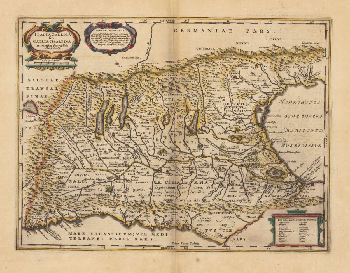
Italia Gallica sive Gallia Cisalpina ex conatibus Geographicis Abrah. Ortelij. Petrus Kaerius Caelavit.
Janssonius, Joan. – Northern Italy (Cisalpine Gaul) · Copper Engraving, Hand Colored · Novus Atlas / Atlas Maior, Amsterdam · 1649
Eigenschaften
- Published: Amsterdam
- Published date: 1649
- Issue date: 1649-60
- Category: Lombardy
- Type: map
- Technique: Copper engraving / hand colored.
- Size: 34.7 x 46,4 cm (13.75 x 18,25 inches).
- Bibliography: Koeman I / 7010H:1
- Stock number: 36164
- Condition: In excellent condition.
Article description
Article description
Original antique hand-colored copper engraving, from Joan Janssonius's great 'Novus Atlas', published in Amsterdam, 1649. Depicting Northern Italy (Cisalpine Gaul), this map is a fine example of 1640s European cartography. Image: 34.7 x 46,4 cm (13.75 x 18,25 inches). An attractive and historically significant 17th-century map for the discerning collector. Johannes Janssonius (1588–1664), also known as Jan Jansson, was one of Amsterdam's most prolific cartographers and publishers of the Dutch Golden Age. His great 'Novus Atlas' (later expanded into the 'Atlas Maior') rivalled the output of the Blaeu firm and contained hundreds of maps covering the entire known world. Janssonius worked closely with Henricus Hondius and acquired many of the Mercator-Hondius plates, ensuring continuity with the finest cartographic tradition of the 16th century. His maps are distinguished by fine engraving, elaborate allegorical cartouches, and high-quality hand coloring. They are held in institutions worldwide, including the Rijksmuseum in Amsterdam and the Library of Congress. The map is ornated with the title cartouche and "privilegium" on the upper left side and two more cartouches (upper left side, lower right side). Villages and towns are shown as miniature views. A fine example from Novus Atlas / Atlas Maior, Amsterdam, sought after by collectors of antique maps of Italy, antique maps of Northern Italy (Cisalpine Gaul), and antique hand-colored copper engravings for sale. In good condition consistent with age. Light age-toning to the sheet, as expected for a 17th-century engraving. Centerfold as published.Janssonius, Joan. – Northern Italy (Cisalpine Gaul) · Copper Engraving, Hand Colored · Novus Atlas / Atlas Maior, Amsterdam · 1649
Koeman I / 7010H:1
You might also be interested in the following products
 Moluccae Insulae...
 Original antique copper engraving, hand colored in outline and wash when published. A highly decorative map of the...
€550.00
 Pascaert van...
 Original antique copper engraving, uncolored as published. Detailed chart of the Northeastern part of Canada,...
€1,750.00
 Pascaarte vande...
 Copper Engraving, uncolored by van Keulen, Joan, published 1684-1704 by Johannes van Keulen, Amsterdam. Image size:...
€1,100.00
 Pedemontanae...
 Original antique copper engraving, uncolored, from the 'Theatrum Orbis Terrarum' by Abraham Ortelius, the...
€650.00
Recently viewed products