de Wit, Frederick
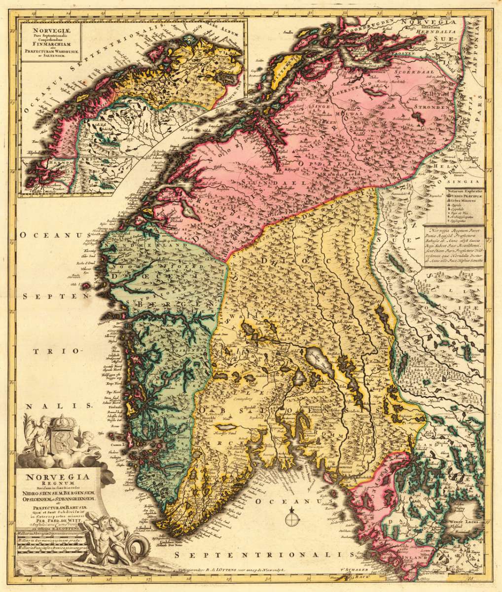
Norvegia Regnum Divisum in suos Diocaeses Nidrosiensem, Bergensem, Opsloensem, et Stavangriensem. Et Praefecturam...
Eigenschaften
- Published: Cornelis Danckerts , Amsterdam
- Published date: 1696
- Technique: Copper engraving / Original color.
- Type: Antique Map, map
- Issue date: 1696
- Category: Norway
- Size: 585 by 495mm (23 by 19½ inches).
- Stock number: 29746
- Condition: In excellent condition.
Article description
Article description
Copper engraving, hand colored in wash.You might also be interested in the following products
 Moluccae Insulae...
 Original antique copper engraving, hand colored in outline and wash when published. A highly decorative map of the...
€550.00
 Pascaert van...
 Original antique copper engraving, uncolored as published. Detailed chart of the Northeastern part of Canada,...
€1,750.00
 Pascaarte vande...
 Copper Engraving, uncolored by van Keulen, Joan, published 1684-1704 by Johannes van Keulen, Amsterdam. Image size:...
€1,100.00
 Guiana sive...
 Copper engraving, hand colored in outline and wash when published. French text edition. Decorative map extending...
€325.00
Recently viewed products