The following products have been found matching your search "continuing": 15
Or did you mean: continued | containing | continent | convincing | contingens | combining | contributing | Europe continent
No results were found for the filter!
 Amerique Meridionale Pour servir á l´Histoire Generale des Voyages.
 Copper engraving, hand colored in wash. Decorative map of South America published ca. 1760 in an atlas by Nicolaus...
€95.00
 La Description de l'Égypte: Plan Général de L´Ile et de ses Environs
 Original copper engraving, uncolored. General plan of the island and its surroundings, plan of the Isis Temple....
€175.00
 A map of Continent of the East-Indies &c. Explaining what belongs to England, Spain and Holland &c. - By H....
 Copper engraving, decorative handcolored in outline. Small wide and decorative map showing the continent of India...
€375.00
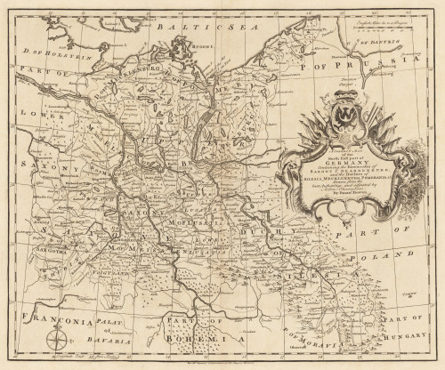
 The N.E. Part of Germany Containing the Dominions of the Electors of Brandenburg and Saxony, the Dutchy of...
 Copper engraving, uncolored as published. Small and decorative map of the northeastern part of Germany mainly...
€145.00
 Western Autralia containing the Settlements of Swan-River and King George´s Sound from recent Surveys sent to the...
 Steel engraving, hand colored in outline when published. This map shows West Australia.
€182.00
 The west Part of Barbary containing Fez. Marocco Algiers and Tunis. - The east Part of Barbary containing Tripoli...
 Copper engraving, uncolored as published. Published in Hermann Moll's 'Atlas Minor' 1736 in...
€120.00
 The N.E. Part of Germany Containing the Dominions of the Electors of Brandenburg and Saxony, the Dutchy of...
 Copper engraving, hand colored in outline when published. Small and decorative map of the northeastern part of...
€145.00
 Turkey II. Containing the Northern Part of Greece. - Published under the Superintendence of the Society for the...
 Steel engraving, hand colored in outline when published. A very decorative map which shows Turkey in Southeast...
€39.00
 A Correct Map of the North East Part of Germany containing the Electorates...
 Original Kupferstich, unkoloriert erschienen. Dargestellt wird der nordöstliche Teil Deutschlands mit Teilen von...
€145.00
 New Universal Atlas Containing Maps of the various Empires, Kingdoms, States and Republics of the World...
 Original antique lithograph. Title page with an lithograph from the first landing of Columbus in the New World,...
€120.00
 A map of the West Indies and Middle Continent of America from the latest Observations by John Blair L.L.D. &...
 Copper engraving, uncolored, engraved by Thomas Kitchin. The map shows the West Indies, Florida, the Southern United...
€375.00
 Das Mitternächtliche vesteland. - Continent Septentrional.
 Copper engraving, hand colored in outline and wash. Small and decorative map showing the North Pol with Greenland...
€70.00

