The following products have been found matching your search "explanation": 122
Or did you mean: explanations | explanantions | explorations | explantions | exploitation | explations | exploration
No results were found for the filter!
 Typus Aetiologicus II. Sistens unu obtutu Ductum totius itineris Xenophontaei et Stathmorum Particorum Isodori...
 Original copper engraving, hand colored in outline when published. An unusual rare historical map of Persia with the...
€425.00
 Geological map of the Red River and the Rio Grande
 Original lithograph, hand colored in wash when published. This early geological map depitcs the Witchita Mountains...
€125.00
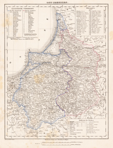
 Ost-Preussen
 Lithograph, original hand color in outline. Detailed map of Eastern Prussia. Shows detailed the region between...
€80.00
 Ost-Preussen
 Lithograph, original hand color in outline. Detailed map of Eastern Prussia. Shows detailed the region between...
€80.00
 Provinz Posen
 Lithograph, original color in outline and wash. Detailed map of the province of Posonia with Posen in its centre....
€65.00
 Nassouia Principatus, cum omnibus ei pertinentibus Comitatibus Dominiis, ac Praefecturis, ut et confiniis intra...
 Copper engraving, hand colored in outline when published. This antique map shows Nassau and the neighbouring...
€400.00
 Königreich Sachsen in Wien bey Tranquillo Mollo.
 Copper engraving, hand colored in outline when published. This antique map shows us the Kingdom of Germany in the...
€195.00
 Eigentlicher Grundriß der Statt Eger wie die selbe von S: Excell Herz Carol Gustaff Wrangel den 14. Juny 1647....
 Original antique copper engraving, uncolored. Engraved after a sketch by G. W. Kleinsträtl, published in the...
€195.00
 Hamburg
 Woodcut published 1628 in the 'Cosmographia' by Sebastian Münster, printed on the full text sheet. German...
€75.00
 Creta Iouis magni, medio iacet insula ponto. Ex conatibus geographicis Abrahami Ortelii.
 Original copper engraving, published 1624 in the famous historical Atlas "Parergon" (Latin text-edition) by Abraham...
€495.00
 Der westliche Theil von Mittel-Asien oder Turan mit einem Theil der angaenzenden Laender. Entworfen und gezeichnet...
 Original antique copper engraving, hand colored in outline when published. A detailed and interesting map by the...
€145.00
 Tabula Ducatus Britanniae Gallis le Gouvernemt. General de Bretagne insuos Novem Episcopatuss omnes Turonensi Aurel....
 Original antique copper engraving, hand colored in outline and wash when published. Shows Brittany with the offshore...
€175.00

