The following products have been found matching your search "map of turkey": 82
Or did you mean: maps | map | world map | world maps | MAPS OF THE WORLD | map asia | wall map | map of london
No results were found for the filter!
 Insularum Archipelagi Septentrionalis seu Maris Aegaej Accurata Delineatio Auctore I. Laurenbergio.
 Original antique copper engraving, decorative hand colored in outline when published. Decorative map showing in...
€745.00
 Tabula Itineris Decies Mille Graecorum sub Cyro contra fratrem suum Artaxerxem, Regem Persarum; eorumque Reditus sub...
 Original antique copper engraving, decorative hand colored in outline. Published in a Latin text edition of J....
€545.00
 Natolia, quae olim Asia Minor.
 Original antique copper engraving, hand colored in outline when published. Decorative map of 'Asia Minor'...
€450.00
 Natolia, quae olim Asia Minor.
 Original antique copper engraving, uncolored. Decorative map of 'Asia Minor' with the Mediterranean Sea...
€450.00
 Natolia, quae olim Asia Minor.
 Original antique copper engraving, hand colored in outline when published. Decorative map of 'Asia Minor'...
€450.00
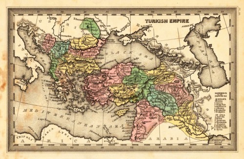
 Turkish Empire.
 Steel engraving, hand colored in outline and wash when published. This fine small engraved old map shows Turkish...
€35.00
 Das Osmanische Reich in Europa mit einem Theile desselben in Asien nebst den Angränzenden oesterreichischen und...
 Original lithographed map, uncolored. Engraved by W. Pobuda. The large map shows the region between Kolomyja in the...
€1,200.00
 Die europaeische Türckey - Turquie en Europe
 Copper-engraving, handcolored in wash and outline. Small map of Southeast Europe showing mainly the posessions of...
€80.00
 Die europaeische Türckey - Turquie en Europe
 Copper engraving published in Allain M. Mallet's description of the world 'Description De L' Univers,...
€45.00
 Originalkarte der Central-Türkei - Nach Aufnahmen vom Jahre 1869 entworfen von Ferdinand von Hochstetter 1870.
 Lithograph, uncolored as published. This antique map shows us detailed the region Nis - Leskovac towards Sofia and...
€65.00
 Insularum Archipelagi Septentrionalis seu Maris Aegaei Accurata Delinatio Auctore I. Laurenbergio.
 Original antique copper engraving, hand colored in outline when published. The map was published in Joan....
€495.00
 General Karte Des Osmanischen Reichs.
 Steel engraving, hand colored in outline, when published. Decorative and interesting map showing the Osman Imperium,...
€75.00

