The following products have been found matching your search "mile": 26
No results were found for the filter!
 A New and Accurate Map of the Netherlands from the Sieur Roberts Atlas with Improvements.
 Original antique copper engraving, uncolored. Engraved by J. Gibson Original antique map showing the north-western...
€45.00
 Plan of Dieppe with the New Fortifications and Projected Works.
 Original antique copper engraving, uncolored. Original antique map of Dieppe, France, published in,The Geographical...
€65.00
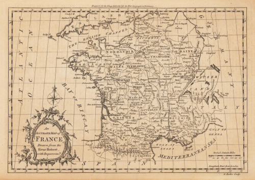
 An Accurate Map of France Drawn from the Sieur Robert, with Improvemts.
 Original antique copper engraving, uncolored. Published in London and engraved for the 'New Geographical...
€80.00
 Plan of the Town and Mole of Agde With the Fort de Brescou
 Original antique copper engraving, uncolored. Engraved by F. A. Aveline. Original antique plan of the town and mole...
€90.00
 Deutschland
 Engraved map printed by 4 plates on 2 sheets. Two title cartouches and two mile markers in 4 decorative cartouches...
€745.00
 Egerani Circulus Repraesentatio Geographice Circuli Egerani, nec non Elnbogensis, in quo simulviae Egeranae in...
 Original antique copper engraving. Hand colored in outline and wash. This decorative map shows the Kingdom of...
€350.00
 Plan de L`Attaque D´Egra
 Original antique copper engraving. Rare original plan of Eger (Cheb) in the far west of the Czech Republic by G. L....
€180.00
 Carte du Péloponèse.
 Original antique copper engraving, colored in outline when published. Antique map of the Peloponnes in Greece, hand...
€95.00
 Le Cercle de la Basse Saxe, subdivisé en touts, Les Estats et Principautés qui le composent aParle S. Sanson,...
 Original antique copper engraving, hand colored in outline and wash when published. Engraved map, in contemporary...
€320.00
 Nieder- und Ober-Oesterreich oder das Erzherzogthum Oesterreich unter & ob der Enns und das Herzogthum Salzburg
 Original Kupferstich in zeitgenössischem Flächenkolorit. Bearbeitet von C. Gräf. Diese antike Landkarte zeigt das...
€90.00
 Charte des Osmanische Reichs in Asien - Nach den neuesten astronomischen Ortsbestimmungen und besten Hülfsmitteln neu...
 Original antique copper engraving, hand colored in outline and wash when published. Antique map of the Ottoman...
€145.00
 Repraesentationem Circuli Saxonici Inferioris
 Old colored copperplate engraving after F. L. Güssefeld by Homann Erben, 1784. With French head title...
€200.00

