- Published: Venice
- Published date: 1692
- Category: Deutschland
- Issue date: 1692
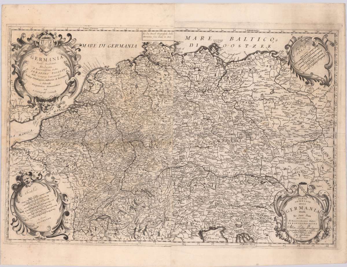
- Type: map
- Technique: Engraving, uncolored.
- Size: 69 x 90,5 cm (27.25 x 35,75 inches).
- Stock number: 35094
- Condition: Very good.
Article description
Engraved map printed by 4 plates on 2 sheets. Two title cartouches and two mile markers in 4 decorative cartouches in the corners. Kupferstichkarte, gedruckt v. 4 Platten auf 2 Blatt. In den Ecken zwei Titelkartuschen und zwei Meilenzeiger in 4 dekorativen Kartuschen. Germany is shown with neighboring countries. On the backside there is a engraving of the island of Gotland and one of the city of Kiel. The Italian cartographer Vincenzo Coronelli was particularly impressive in his map design. Like Jaillot, he also worked at the court of Louis XIV. His maps are still considered a masterpiece of baroque map art. Uncolored copy in very good condition with a strong impression. Dargestellt wird Deutschland mit angrenzenden Ländern. Auf der Rückseite befinden sich jeweils eine Abbildung der Insel Gotland und der Stadt Kiel. Der italienische Kartograph Vincenzo Coronelli bestach insbesondere in seiner Gestaltung der Karten, auch er war wie Jaillot am Hof Ludwig XIV. tätig. Seine Karten gelten bis heute noch als ein Meisterwerk der barocken Kartenkunst. Unkoloriertes Exemplar in sehr gutem Zustand, mit in einem kräftigen Abdruck.
Germania, Parte Occidentale & Orientale
You might also be interested in the following products
 Germania Antiqua
  L´Empire...
  Germania...
  Germania...