The following products have been found matching your search "red": 30
No results were found for the filter!
 Annandale - Tivoli - Barrytown - Madalin - Upper Red Hook
 Lithograph, original color in wash when published. This antique map shows five towns (Annandale, Barrytown, Upper...
€95.00
 The Red Sun
 Original lithograph in colors, printed and published at Mourlot 1972 in Paris. Unnumbered edition published in...
€345.00
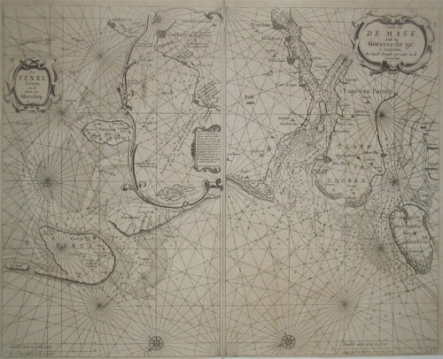
 a. De Texel Stroom en de Gaten van Marsdiep. Inset (c. 24 x 12cm) : Caarte vande Rede en Haven van Medenblick hoemen...
 Two sea-charts on one doublepage. The left one is showing Medenblick, Texel and Wieringen. Additional there is a...
€1,250.00
 Sonne mit rotem Pferd - Sun with Red Horse
 Original lithograph in colours published at Galerie Maeght in Derriere le Mirroir in 1979. Edition 20,000 unsigned...
€280.00
 Profil und rotes Kind - Profil and red child
 Original color lithograph, printed 1960 at Mourlot and Draeger in Paris. Published in Marc Chagall's 'Catalogue...
€245.00
 The red rooster - Der rote Hahn
 Original lithograph in colors published in the series by J. Lassaigne in 1957 Paris. Edition 6000 unsigned and...
€295.00
 Geological map of the Red River and the Rio Grande
 Original lithograph, hand colored in wash when published. This early geological map depitcs the Witchita Mountains...
€125.00
 Originalkarte der Canarischen Inseln Gomera, Hierro, Canaria. Nach den Messungen von K. v. Fritsch den Englischen...
 Lithograph, original hand color in outline.
€90.00
 Empire des Abyssins
 Copper engraving, hand colored in wash and outline, published in Allain Manesson Mallet's description of the...
€50.00
 Originalkarte der Nord-Abessinischen Grenzlande - Bogos, Mensa, Marea, und der umliegenden Gebiete. - Hauptsächlich...
 Original lithograph, hand colored in outline and wash when published. Map of the regions to the North-Abessinian...
€75.00
NEW
 Circles
 Original color lithograph, signed in pencil and numbered 20/125. Untitled original color lithograph on white...
€12,000.00
NEW
 Inspiration
 Original color lithograph, signed in pencil and numbered 72/125. Untitled original color lithograph on white...
€12,000.00

