The following products have been found matching your search "regione": 145
No results were found for the filter!
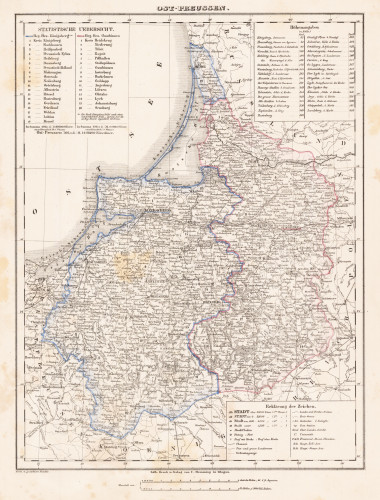
 Ost-Preussen
 Lithograph, original hand color in outline. Detailed map of Eastern Prussia. Shows detailed the region between...
€80.00
 Ost-Preussen
 Lithograph, original hand color in outline. Detailed map of Eastern Prussia. Shows detailed the region between...
€80.00
 Spitzberg und Neu Zemble - Spitzberg et N. Zemble.
 Copper engraving, hand colored in wash and outline. Attractive antique map of Spitzberg and the Polar region from...
€125.00
 Archipel des Indes Orientales, qui comprend les Isles de la Sonde, Moluques et Philippines, tirées des Cartes du...
 Copper engraving, hand colored in outline. Detailed map of the region from Sumatra and Malaca and Southern China to...
€425.00
 Das Osmanische Reich in Europa mit einem Theile desselben in Asien nebst den Angränzenden oesterreichischen und...
 Original lithographed map, uncolored. Engraved by W. Pobuda. The large map shows the region between Kolomyja in the...
€1,200.00
 Tabulae Geographicae. Principatus Brandbenburg: Culmb: sive Baruthini pars Inferior cum adjacentibus Regionibus...
 Original antique copper engraving, hand colored in outline and wash when published. This decorative map shows the...
€600.00
 Nuoua Carta delle Isole di Sunda come Borneo Sumatra e Java Grande & C.
 Original antique copper engraving, hand colored in outline and wash. Detailed map of the region from Sumatra and...
€325.00
 Die Gegend des Rheins von Speyer bis Mayntz nebst der Situation längst der Bergstrasse zwischen dem Rhein und dem...
 Original Kupferstich in zeitgenössischem Grenz- und Flächenkolorit. Die Karte von 2 Platten gedruckt mit...
€850.00
 S.R.I. Circulus Rhenanus Inferior sive Electorum Rheni complectens tres Archiepiscopatus, Moguntinum Coloniensem et...
 Copper engraving, hand colored in outline and wash when published. A detailed map of Lower Rhine region. The title...
€230.00
 S.R.I. Circulus Rhenanus Inferior sive Electorum Rheni complectens tres Archiepiscopatus, Moguntinum Coloniensem et...
 Copper engraving, hand colored in outline and wash when published. A detailed map of Lower Rhine region. The title...
€210.00
 Bavariae Utriusove Cum in Ferioris Tusuperioris vera et ad amusim descriptio.
 Original antique copper engraving, uncolored. This map of Bavaria shows the region between Reichenbach in the north...
€595.00
 Prospect und Grundris der des Heil. Röm. Reichs-Stadt Nürnberg samt Ihren Linien und Gegend ...
 Copper engraving, hand colored in outline and wash when published. The large and decorative map of Nürnberg with its...
€550.00

