The following products have been found matching your search "stock": 10
No results were found for the filter!
 North America Index Map to Canada and the United States
 Original antique steel engraving, hand colored in outline when published. This North America map shows the East...
€65.00
 North America Sheet I Nova-Scotia with Part of New Brunswick and Lower Canada.
 Original antique steel engraving, hand colored in outline when published. This North America map shows the east...
€70.00
 North America Sheet VI New York, Vermont, Maine, New Hampshire, Massachusetts, Connecticut, Rhode Island, and New...
 Original antique steel engraving, hand colored in outline when published. This North America map shows the east...
€95.00
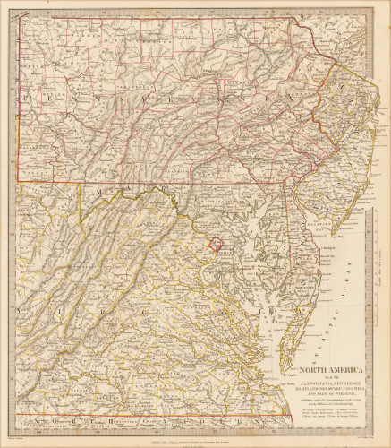
 North America Sheet VII Pennsylvania, New Jersey, Maryland, Delaware, Columbia and Part of Virginia.
 Original antique steel engraving, hand colored in outline when published. This North America map shows Pennsylvania,...
€60.00
 North America Sheet XIII Parts of Louisiana, Arkansas, Mississippi, Alabama & Florida.
 Original antique steel engraving, hand colored in outline when published. This North America map shows Parts of...
€110.00
 British North America
 Original antique steel engraving, hand colored in outline when published. An unusual map of British North America or...
€45.00
 Mappemonde ou Carte Generale de l'Univers sur une projection nouvelle d'une sphere ovale pour mieux...
 Antique original copper engraving. Rare first edition of this unusual large world map on an ovoid projection,...
€950.00
 (Vues de Paris / vues de Italie)
 Original antique book without title page, leather binding with floral embossing. 59 etchings. "Campo Vaccine,...
€2,950.00
 Karte von Brasilien - Erstes Stück von dem Amazonenfluße bis an die Bay Aller Heiligen - zur allgemeinen Historie der...
 Copper engraving, uncolored as published. Engraved map showing Brazil with its regions Maragnan, Seara, Rio Grande,...
€86.00
 Grundriss von der Bay der Insel St. Vincent, einer von den Eylanden des grünen Vorgebirges im 16 Gr. 50 Min. Norder...
 Copper engraving, uncolored as published. This beautiful map shows the ground plan of the island of St. Vincent....
€50.00

