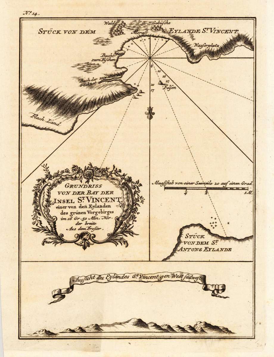
Bellin, Nicolaus
Grundriss von der Bay der Insel St. Vincent, einer von den Eylanden des grünen Vorgebirges im 16 Gr. 50 Min. Norder...
Eigenschaften
- Published: Merkur , Leipzig
- Published date: 1747
- Type: Antique Map, map
- Technique: Copper engraving / Uncolored
- Issue date: 1747
- Category: Canary Islands
- Size: 203 by 148mm (8 by 5¾ inches).
- Stock number: 18931
- Condition: In excellent condition. 203 by 148mm (8 by 5¾ inches).
Article description
Article description
Copper engraving, uncolored as published. This beautiful map shows the ground plan of the island of St. Vincent. A fine detailed and interesting map engraved by Bellin after earlier voyages. Published in the German edition by Schwabe in Leipzig of Bellin's travel books.You might also be interested in the following products
 Zahara - Bornos
 Original antique hand colored copper engraving, published in volume V of the town book "Civitates Orbis...
€480.00
 Bornnes - Zahara
 Hand colored copper engraving, published in the town book "Civitates Orbis Terrarum" by Georg Braun and...
€480.00
 Spain and Portugal
 Lithograph, hand colored in outline when published. Large decorative doublepage handcoloured lithograph in outline,...
€120.00
 Hispania Antiqua...
 Copper-engraving, handcolored in outline, when published. Decorative map of Historic Spain. Divided up in three...
€195.00
Recently viewed products