Eastern US
No results were found for the filter!
 Carte Des Possessions des Colonies Anglaises dans le Continent de L'Amerique Septentrionale et Partie de la...
 Copper engraving, hand colored in outline when published.
€2,750.00
 A new map of Georgia with its roads & distances. Published by Thomas, Cowperthwait & Co. No. 253 Market...
 Steel engraving, hand colored in outline and wash. This map of Georgia centers our attention on the roads and...
€250.00
 Carte de la Partie Sud des Etats Unis de L'Amerique Septentrionale. Par M. Bonne, Ingénieur-Hydrographe de la...
 Copper engraving, hand colored in outline and wash. Detailed map including Virginia, Georgia and the Carolinas,...
€195.00
 Neueste Karte von Pennsylvania mit seinen Canaelen, Eisenbahnen & c. Nach den besten Quellen bearbeitet. 1845.
 Steel engraving, hand colored in outline and wash when published. Detailed map of the state of Pennsylvania. Inside...
€65.00
 North America Sheet XI Parts of North and South Carolina
 Steel engraving, hand colored in outline when published. This antique map shows the East Coast with North and South...
€110.00
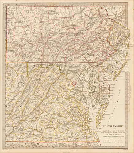
 North America Sheet VII Pennsylvania, New Jersey, Maryland, Delaware, Columbia and Part of Virginia.
 Original antique steel engraving, hand colored in outline when published. This North America map shows Pennsylvania,...
€60.00
 North America Sheet VI New York, Vermont, Maine, New Hampshire, Massachusetts, Connecticut, Rhode Island, and New...
 Original antique steel engraving, hand colored in outline when published. This North America map shows the east coast...
€95.00
 North America Index Map to Canada and the United States
 Original antique steel engraving, hand colored in outline when published. This North America map shows the East coast...
€65.00
 New Map of the City of Philadelphia.
 Original hand colored lithograph, folded and published as pocket map of the city of Philadelphia. A large and...
€950.00
 Carte Géographique, Statistique et Historique du district de Colombie.
 Copper engraving, hand colored in outline and wash when published. Fine engraved map of the 'District of...
€245.00
 Neueste Karte von New York mit seinen Canaelen, Strassen, Eisenbahnen, Entfernungen der Hauptpunkte und Routen für...
 Steel engraving, hand colored in outline when published. Detailed engraved antique map of the state of New York....
€145.00
 Neueste Karte von New York mit seinen Canaelen, Strassen, Eisenbahnen, Entfernungen der Hauptpunkte und Routen für...
 Steel engraving, hand colored in outline when published. Detailed engraved antique map of the state of New York....
€155.00
Recently viewed products

