Buchon, Jean Alexandre
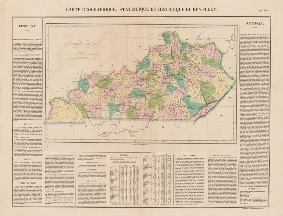
Kentucky. Carte Géographique, Statisque et Historique Du Kentucky.
Buchon, Jean Alexandre – Kentucky. Carte Géographique, Statisque et Historique D... · Antique Map, Copper Engraving · 440 x 610mm · Carez, Paris 1825
Eigenschaften
- Published: Carez , Paris
- Published date: 1825
- Technique: Copper engraving / Original color.
- Type: Antique Map, map
- Issue date: 1825
- Category: Kentucky
- Size: 440 by 610mm (17 by 24 inches).
- Stock number: 14010
- Condition: In excellent condition. 440 by 610mm (17 by 24 inches).
Article description
Article description
Copper Engraving, hand-colored in outline by Buchon, Jean Alexandre, published 1825 by Carez, Paris. Image size: 440 by 610mm (17 by 24 inches). A detailed map from Buchon's 1825 Atlas géographique, the French edition of Carey & Lea's celebrated American atlas. Jean Alexandre Buchon (1791–1846) was a French historian and geographer who produced the influential Atlas géographique, statistique, historique et chronologique des deux Amériques et des îles adjacentes (1825), published in Paris by J. Carez. This atlas was the French edition of the celebrated Carey & Lea atlas of the United States. Each map was surrounded by letterpress text describing the economic, political, geographical, and historical statistics of the depicted region in French, making it an extraordinary reference work for European readers at the dawn of the Americas' independence era. The maps were engraved in Paris to the highest standards of the day and remain important primary documents for the study of early 19th-century American geography as understood by European scholars. This antique map of Kentucky. Carte Géographique, Statisque et Historique Du Ken was published in 1825 by Carez, Paris (440 by 610mm (17 by 24 inches).). It is printed as a copper engraving, hand-colored in outline. The map documents the region with careful attention to rivers, settlements, roads, and political boundaries, reflecting the geographical knowledge available at the time of publication and offering an invaluable primary source for historians and collectors of North American antique cartography. In excellent condition.Buchon, Jean Alexandre – Kentucky. Carte Géographique, Statisque et Historique D... · Antique Map, Copper Engraving · 440 x 610mm · Carez, Paris 1825
Recently viewed products