Starling, Thomas
France. By T. Starling.
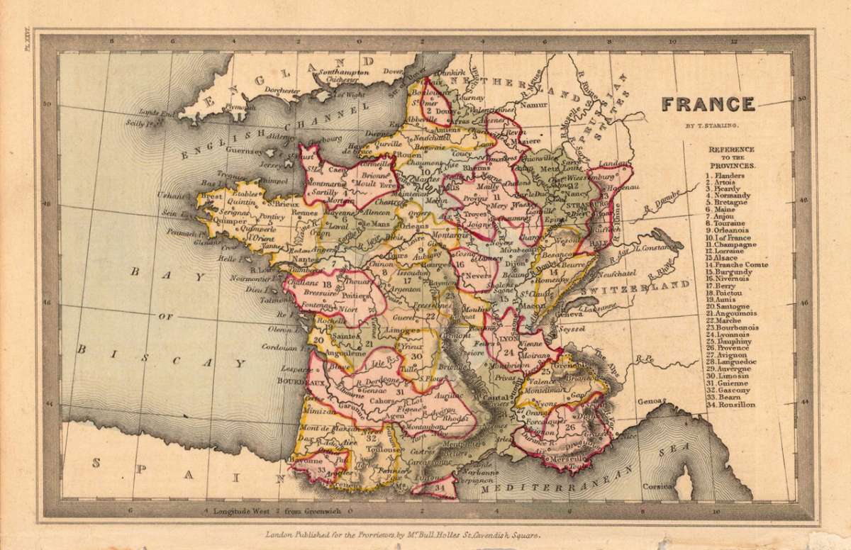
Thomas Starling – France. By T. Starling. · Original Antique Steel Engraving, Hand Coloured · Perkins & Bacon · London 1833
Eigenschaften
- Published: Perkins & Bacon , London
- Published date: 1833
- Type: Antique Map, map
- Technique: Steel engraving, original color
- Category: France
- Issue date: 1833
- Size: 90 by 140mm (3½ by 5½ inches).
- Stock number: 19292
- Condition: In excellent condition. 90 by 140mm (3½ by 5½ inches).
Article description
Article description
Original antique steel engraving, hand coloured in outline, showing France. Published by Perkins & Bacon, London, 1833. Sheet: 90 by 140mm (3½ by 5½ inches).. A fine decorative example of antique cartography by Thomas Starling, rich in period detail and historical significance. Thomas Starling was a London engraver active in the early nineteenth century who contributed maps and illustrations to various British geographical publications of the period. The map shows detailed France divided up into its provinces. Inside the map are many place names, rivers, etc. Fine designed and engraved small map by the London engraver Thomas Starling published in his 'Geographical Annual' 1833 showing a fair amount of place names, rivers and political borders of the different countries and territories.Thomas Starling – France. By T. Starling. · Original Antique Steel Engraving, Hand Coloured · Perkins & Bacon · London 1833
You might also be interested in the following products
 Artesia
 Original antique copper engraving, hand coloured when published, depicting Artois. Published by M. Seutter, Augsburg,...
€145.00
 Artesia. Iacobo...
 Original antique copper engraving, hand coloured when published, depicting Artois. Published in Antwerpen, 1588....
€295.00
 Elsass
 Original antique copper engraving, hand coloured when published, depicting Elsass - Alsatia. Published by Jodocus...
€240.00
 Li contorni di...
 Original antique copper engraving, hand coloured when published, depicting Paris. Published by Antonio Zatta.,...
€180.00
Recently viewed products